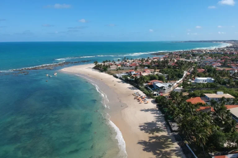
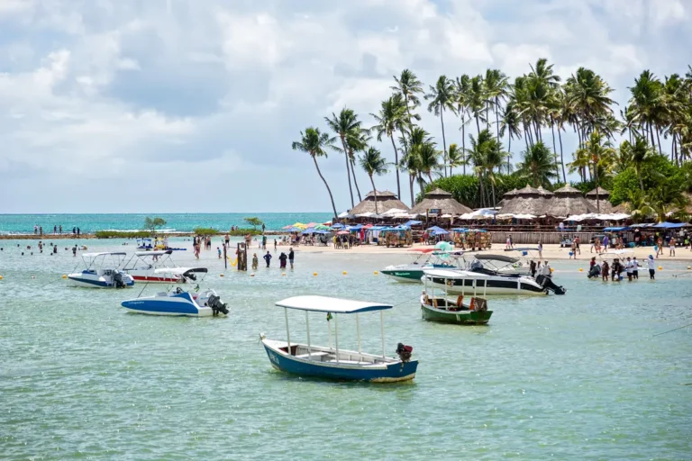
The Pajuçara natural pools are Maceió’s classic excursion: at low tide, a jangada raft takes you from the shore to the reefs, where the shallow water reveals fish and coral formations. The key is picking the right time and not treating it like a regular beach day.
Plan your departure around the tide table: the useful window usually lasts only a few hours and changes daily.
What are the Pajuçara natural pools?
They are areas sheltered by reefs, relatively close to the Pajuçara coast. When the sea recedes, shallow pools of clear water appear, perfect for spotting small fish and enjoying a calm float. Boarding happens on the beach, on jangada rafts run by local operators.
Check the tide table for the day of your trip and aim for the lowest levels, ideally around 0.5 m or less. The departure time is set by the raft captain, so you can’t just show up any time in the morning. Around full and new moons, the tidal range tends to favor lower tides, but the specific date is what really matters.
Bring a mask, sunscreen, a hat, and cash or payment confirmation. Don’t step on the corals, don’t touch the animals, and avoid feeding the fish. The water may look calm, but the return trip gets harder as the tide comes in.
How to get to Pajuçara
Pajuçara sits on Maceió’s urban waterfront, near Ponta Verde and the Jaraguá neighborhood. From beachfront hotels, you can walk or take a ride-hailing app; from the airport, use a transfer, taxi, or ride-hailing car and confirm the boarding point with your operator. Arrive before the scheduled time to find your raft without rushing.
What to do on the same day
Pair the trip with a walk along the Ponta Verde waterfront, a Praia do Gunga excursion on another day, and a visit to the Pavilhão do Artesanato. For a longer itinerary, also check out Maragogi in 4 days. To explore more water experiences in the region, check out the boat tour of the Nine Islands.
Are the Pajuçara natural pools right in front of the beach?
They are out at sea, in a reef area usually reached by jangada raft.
Do I need to book in advance?
In high season, booking helps align your time with the tide; confirm the operator and boarding point.
Can I go with kids?
Yes, as long as the child wears a life jacket when advised and stays supervised at all times.
In July 2026, confirm tide, water quality, and local rules before heading out.
Also check the guidelines from the Ministry of Tourism to help plan your visit.
Conclusion
The Pajuçara natural pools work best when the tide guides your trip. With a well-chosen time, sun protection, and respect for the reefs, you’ll enjoy one of the easiest experiences to fit into a Maceió itinerary. Plan with Voyage Voyage and confirm conditions on the day.
Praia do Gunga is one of the easiest day trips to fit into a Maceió vacation: it sits on the southern coast, with sea framed by coconut palms, a viewpoint at the entrance, and colorful cliffs you can reach by buggy, ATV, or boat. The trick is sorting out your transport and the tide before you head out.
To really get to know Praia do Gunga, set aside a full day, arrive early, and save the cliffs for the buggy or ATV tour. The mix of beach, Lagoa do Roteiro, and cliffs makes for a varied itinerary without needing to switch hotels.
Why visit Praia do Gunga
Located about 12 km from Barra de São Miguel, Praia do Gunga pairs sea and coconut groves on one side with Lagoa do Roteiro on the other. The official portal Visite Alagoas highlights the colorful cliffs and boat tours as the destination’s main draws.
The viewpoint sits right by the beach access and offers a sweeping view of the coconut grove, the sand strip, and Lagoa do Roteiro. It’s a quick stop, but it helps you get your bearings before deciding where to spend the day.
Visit the cliffs by buggy or ATV
The tours run along the coastline and reach the cliffs, where the colorful terrain makes for the best photos. Arrange the duration, price, and stop points directly with your driver. If you’d rather leave from Maceió, the Praia do Gunga excursion already handles the transport and the beach day for you.
Take a boat ride
Lagoa do Roteiro offers an alternative to the road access and can be explored by speedboat or local vessel, depending on operations and conditions that day. The crossing is especially worthwhile for anyone staying in Barra de São Miguel.
From Maceió, take AL-101 Sul toward Barra de São Miguel and follow the signs for the beach and viewpoint. Driving gives you control over your schedule; a tour adds convenience but ties you to the group’s itinerary. You can also arrive by boat from Barra de São Miguel. Confirm parking, the crossing, and road conditions the day before. If you want to pair this trip with another beach in the region, check out our guide to the best beaches in Maceió, which also covers Praia do Francês.
On holidays and school breaks, the entrance and tours get busier: leaving early usually makes a big difference in how much beach time you get.
Where to eat and how long to stay
The beach area has a solid setup of stalls, restaurants, and clubs serving seafood dishes, snacks, and drinks. Before you sit down, ask about minimum consumption and day-use fees. A full day lets you hit the viewpoint in the morning, the beach at midday, and the cliffs in the afternoon—without turning the outing into a race.
Best time and time of day
The drier months tend to offer better conditions for the beach and outdoor tours, but coastal weather can shift quickly. Check the forecast and the tide, especially if you plan to use a boat or walk along shallow stretches. The best time to arrive is early, particularly on weekends.
To build a bigger itinerary, combine Gunga with Barra de São Miguel and Praia do Francês. From Maceió, it works perfectly as a day trip; there’s no need to change hotels to sleep near the beach.
Frequently asked questions
Where is Praia do Gunga?
It’s on the southern coast of Alagoas, about 12 km from Barra de São Miguel and roughly 40 km from Maceió, depending on the route.
How do I get from Maceió to Praia do Gunga?
You can go by car, transfer, tour, or combine car and boat via Barra de São Miguel.
What is there to do at Praia do Gunga?
The main options are the beach, the Mirante do Gunga viewpoint, the cliffs by buggy or ATV, and boat rides across the lagoon.
How long should I spend at Praia do Gunga?
A full day is ideal for enjoying the beach, the viewpoint, and the cliffs at a relaxed pace.
Conclusion
Praia do Gunga works great as a day trip from Maceió, as long as you plan your transport, the tide, and your arrival time. With the viewpoint, the beach, and the cliffs all on the same route, the destination delivers variety without complicating your trip.
Maracaípe Beach, in Ipojuca, is the perfect pick if you want to combine surf waves, a laid-back vibe, and a sunset at the river mouth. It sits right next to Porto de Galinhas but has a calmer atmosphere, far from the natural pools scene.
To make the most of Maracaípe, set aside at least half a day, check the tide before heading to Pontal, and save the late afternoon for the sunset. The contrast between the wide-open sand strip and the mangroves at Pontal explains why the beach works so well for both surfers and anyone just looking to slow down.
Why visit Maracaípe Beach
Maracaípe is in the municipality of Ipojuca, just minutes from Porto de Galinhas. According to the Ipojuca city government, the beach stands out for its waves and surfing, while Pontal is where the river meets the ocean. It’s a great trade-off if you find Porto de Galinhas too busy.
Pontal is the most sheltered stretch, where the river meets the sea. You can walk along the sand, take a raft ride through the mangroves, or paddle a stand-up paddleboard. The raft tour from Porto de Galinhas is an option that can be booked with Civitatis.
Surf or watch the waves
The open sea and the waves make this one of the most famous spots on the Pernambuco coast for surfing. If you don’t surf, stay in a safe area, respect local signs, and enjoy watching the maneuvers. For calm swimming, head to Pontal and don’t confuse this stretch with the natural pools of Porto de Galinhas.
Watch the sunset
Get to Pontal before the sun goes down to walk along the river mouth and pick a spot with an open view. Low tide is great for walking on the sand strip, but the river gets shallower; at high tide, the raft ride takes on a whole new scenery.
The waterfront has bars and restaurants serving fish, seafood, snacks, and ice-cold drinks. For more variety, Porto de Galinhas is close by and has restaurants open into the evening. On busy days, check if there’s a minimum spend and whether the place accepts cards before you pick a table.
How to get to Maracaípe Beach
From Porto de Galinhas, the beach is just a few kilometers away and can be reached by car, taxi, ride-hailing app, or buggy. From Recife, take the PE-009 toward Ipojuca and then follow the signs for Porto de Galinhas and Maracaípe. Travel time varies with traffic and the season; check your route on the day of your trip.
The best time depends on what you want to do: mornings for the beach and waves, early afternoon for activities at Pontal, and the end of the day for the sunset. The dry season usually brings more settled days, but the coast can change quickly. Check the tide table when your plans include walking at Pontal or a raft ride.
Frequently asked questions
Where is Maracaípe Beach?
It’s in Ipojuca, on the southern coast of Pernambuco, right next to Porto de Galinhas.
Is Maracaípe good for swimming?
The open sea has waves and requires caution. For more sheltered waters, head to Pontal and follow local conditions.
What to do at Pontal de Maracaípe?
You can walk, take a raft through the mangroves, try stand-up paddleboarding, and watch the sunset.
How long should I stay in Maracaípe?
Half a day is enough to see the main spots; a full day lets you fit in surfing, lunch, and the sunset without rushing.
Conclusion
Maracaípe delivers an experience different from its neighbor Porto de Galinhas: more waves, mangroves, and a special end-of-day vibe. Add this beach to your Pernambuco coast itinerary and use Voyage Voyage to plan your next stops.
Where to stay in Porto de Galinhas depends on the kind of vacation you want: the Vila is the most practical choice for walking out at night; Muro Alto favors resorts and protected waters; Cupe balances beach and lodging; Maracaípe combines peace, surfing, and sunsets. There’s no single winning neighborhood for everyone.
Muro Alto concentrates resort-style lodging and waters protected by reefs. Photo: Voyage Voyage archive.
Vila, Muro Alto, Cupe, or Maracaípe: which one to choose?
Area
Best for
Strong point
Limitation
Vila de Porto
first trips and nightlife
restaurants, shops, and walkable tours
more crowds and competitive rates
Muro Alto
families and resorts
calm sea in protected stretches
fewer shops within walking distance
Praia do Cupe
those who want beach and variety
location between Vila and Muro Alto
sea can have strong waves
Maracaípe
surfing, couples, and quiet
more residential vibe and sunsets
distance and open sea in some spots
Vila de Porto de Galinhas: the most practical base
Stay in the Vila if you want to handle your trip on foot: restaurants, shops, handicrafts, tour agencies, and the central beach are all close by. It’s the easiest base for those who don’t plan to rent a car and for those who love eating out every night.
The cost of this convenience is the crowds. Read reviews about noise, parking, and the actual distance to the beach; “near the Vila” can mean a different walk than the map suggests. To understand the area’s most famous attraction, check out the guide to Porto de Galinhas’ natural pools.
Muro Alto: resort, family, and protected sea
Clear waters and boat tours are part of the Porto de Galinhas experience. Photo: Alex Nepomuceno / Pexels.
Muro Alto is the most consistent choice for those who want to spend much of the day at their lodging’s amenities, with a pool, activities, and access to a stretch of water more sheltered by the reefs. Families with kids often value this setting, but swimming conditions depend on the tide, wind, and the specific stretch of beach.
Outside the resort, there’s less concentrated commerce, and getting to the Vila becomes part of your budget. Confirm whether your lodging offers beach service, meal plans, and transportation: the higher nightly rate can be worth it if you’ll actually use the amenities, but not if you plan to take all your tours elsewhere.
Praia do Cupe: a middle ground, but mind the sea
Cupe works for those who want to stay between the Vila and Muro Alto, with hotels, guesthouses, and condos of various styles. The area can offer better value than the Vila on certain dates, especially for those with a car.
Don’t choose Cupe just because of a photo of the sea. The beach is more exposed, and swimming can involve waves and currents different from the protected pools. Ask your lodging which beach access they use and check local conditions on the day.
Maracaípe: peace, surfing, and sunsets
Maracaípe appeals to those who prefer a less commercial atmosphere, want to surf, or plan to stay near Pontal de Maracaípe. It’s a great base for couples and travelers who put beach, nature, and a slow pace above the convenience of walking back from dinner in the Vila.
The open sea isn’t the best bet for those seeking always-calm water. To get around, you’ll likely use ride apps, taxis, or a car at times. The river tour and proximity to the Pontal are pluses; the distance from the Vila is the main trade-off.
How to decide without getting your stay wrong
Define your nights: if you want to go out every day, prioritize the Vila; if you want amenities, compare Muro Alto.
Read the beach, not just the hotel: check tides, waves, beach access, and the real distance.
Add up the commutes: a lower nightly rate in Cupe or Maracaípe can lose its advantage with daily transportation.
Check the meal plan: a resort with half board changes the math; a guesthouse in the Vila cuts transport costs, but not necessarily meal costs.
Ideal base for different itineraries
On a five-day trip, the Vila makes natural pools and restaurant nights easy; Muro Alto and Cupe work better for beach days; Maracaípe deserves an afternoon or a day with a sunset. The five-day Porto de Galinhas itinerary helps you spread these bases without turning every day into a commute. If you’re extending your trip along the coast, also compare Maragogi and Praia dos Carneiros.
Frequently asked questions
What’s the best area for a first trip?
The Vila de Porto de Galinhas is usually the simplest for a first trip without a car, as it concentrates services and restaurants.
Is Muro Alto close to the Vila?
It’s in the same tourist region, but don’t count on walking to the center. Plan for transportation.
Cupe or Maracaípe: which is quieter?
Maracaípe tends to have a more peaceful vibe; Cupe is a middle ground, with varied lodging and an intermediate location.
Where to stay with kids?
Muro Alto is the most predictable choice for those who value protected waters and resort amenities, always checking tide conditions.
Sources and updates
The Ministry of Tourism identifies Porto de Galinhas, Muro Alto, Cupe, and Maracaípe as beaches in the municipality of Ipojuca. Also check with your chosen lodging and the tide table before booking, as swimming conditions and services vary.
Lake Atitlan looks like a single destination on the map, but your trip changes completely depending on which village you choose. Panajachel makes transport easy, San Juan brings you closer to art studios and cooperatives, while San Marcos has a quieter rhythm. Four days let you cross the lake without spending most of your time on boats.
Quick answer: spend four days at Lake Atitlan and use Panajachel or San Juan La Laguna as your base. Dedicate one day to Panajachel and Santa Catarina Palopó, another to San Juan, another to Santiago, and leave one morning free. Choosing your village by its vibe, not just the price, saves you from exhausting commutes.
How to get to Lake Atitlan
Panajachel is the simplest gateway. The town sits about 140 kilometers from Guatemala City, according to the INGUAT tourist guide for Sololá. Shared shuttles leave from the capital and Antigua; local buses cost less but require transfers and more attention to your luggage.
The lanchas connect the villages around the lake. | Photo: Isaac Cortés / Pexels
Once in Panajachel, walk or grab a tuk-tuk to the right dock. There are public boats to the main villages, but not every lancha does the full loop. Confirm your destination before boarding, and check out Lake Atitlan activities if you’d rather have organized transport.
Best time to visit and how many days to stay
The relatively dry season, generally from November to April, offers the best chance of clear skies in the morning. In the rainy season, clouds and showers tend to build up during the afternoon. The lake sits at about 1,560 meters above sea level, so dawn and night can feel cool even when the midday sun is strong.
Four days give you a well-balanced trip. With two nights, you’ll only see your base and one village; with five or more, you can add a hike, a cooking class, or some serious downtime. Schedule the longer crossings for the morning, when the wind tends to be lighter. The ride can get uncomfortable later in the day.
Lake Atitlan in 4 days without picking the wrong village
Day 1: Panajachel and Santa Catarina Palopó
Use the first day to get your bearings at the docks, stroll along Calle Santander, and take in the views of the Tolimán, Atitlán, and San Pedro volcanoes. Then, hop a tuk-tuk to Santa Catarina Palopó. The painted facades, textiles, and community work deserve a respectful visit: people live here, and not every colorful door is a photo prop.
The wind usually picks up on afternoon crossings. | Photo: Jimmy Maffio / Pexels
Day 2: San Juan La Laguna
San Juan blends mural art, weaving cooperatives, medicinal plant gardens, and coffee. Head up to the Kaqasiiwaan viewpoint early if you’re up for the climb, and confirm the local entrance fee. On the way down, pick a cooperative that explains natural dyes and how the artisans are paid. Buying directly cuts out middlemen and makes the visit feel less like a drive-by.
Day 3: Santiago Atitlán
Santiago keeps a strong Tz’utujil identity and is one of the lake’s most important communities. Visit the church of Santiago Apóstol with a low-key attitude, and if you’re looking for the Maximón effigy, hire a local guide: the confraternity can move locations, and the encounter is religious, not a show. Ask before photographing people and ceremonies.
San Marcos La Laguna draws travelers looking for retreats and wellness, but it also has short trails and access to the Cerro Tzankujil reserve. If that’s not your scene, keep the morning free at your base village. A coffee with a lake view and a walk with no set plans can beat squeezing in two more boat rides.
Which Lake Atitlan village to choose
Panajachel has more transport options, ATMs, and restaurants; it’s the most functional base for a first visit. San Juan is better for art and community projects. San Marcos delivers peace, retreats, and plenty of vegetarian food. Santiago has strong local culture and less of a resort feel. San Pedro tends to attract backpackers and nightlife.
For four days, switching hotels rarely pays off. Pick one base and do day trips. If you’re heading on to Antigua Guatemala for three days, you’ll save time by staying in Panajachel on your last night.
Where to eat beyond the tourist menu
Look for pepián, kak’ik, tamalitos, and freshly caught fish, always asking where it comes from. Municipal markets are great for seeing ingredients and eating daily specials, but hygiene and food storage vary. In San Juan, coffee shops tied to growers explain the roast and origin; in San Marcos, you’ll find more vegetarian options.
Where to stay at Lake Atitlan
In Panajachel, stay within walking distance of the dock, but skip rooms right on Calle Santander if noise bothers you. In San Juan, check how many steps separate your lodging from the boat landing. Isolated lakeside hotels offer great views but may require a private lancha for dinner or early departures. Verify nighttime access before you book.
Practical tips for getting around the lake
Carry quetzales in cash, a light rain jacket, sunscreen, and a bag that closes securely. Agree on the tuk-tuk fare before you get in. On the boats, a life jacket should be available; sit further back if you get seasick. Avoid swimming near docks and boat exits.
Leave a buffer of at least one hour before your departure shuttle. Wind, waiting, and crowds all shift boat schedules.
Frequently asked questions
How many days should I spend at Lake Atitlan?
Four days let you visit three villages and still keep one morning free.
What’s the best village to stay in?
Panajachel is the most practical; San Juan is better for art and a community feel.
Is it safe to cross the lake by boat?
Use regular boats, confirm your destination, look for a life jacket, and avoid unnecessary crossings in strong wind.
Can you visit Atitlan as a day trip?
It’s possible from Antigua, but the day gets long and you’ll only see a small slice of the lake.
What currency is used?
The Guatemalan quetzal; cash is important at docks, markets, and for tuk-tuks.
Conclusion
Lake Atitlan is best when you stop trying to collect villages. Choose a base that matches your pace, cross early, and leave time to simply watch life on the shore. Voyage Voyage helps turn the tricky geography into four easygoing days.
Lake Titicaca sits above 12,500 feet and demands more than just a boat ride from Puno. Three days give you time to acclimatize, explore the floating Uros Islands, and choose between Taquile, Amantaní, or a community-based experience—without scheduling a long boat trip right after you arrive.
Quick answer: Spend your first night in Puno before boarding any boat, visit Uros in half a day, and save a full day for Taquile or an overnight stay on Amantaní. Altitude and wind make the effort greater than the distance suggests.
How to get to Lake Titicaca from Peru
Puno is the main base. Juliaca’s airport receives domestic flights and is a short overland trip from the city; official transfers and taxis should be booked in advance. Buses arrive from Cusco, Arequipa, and Bolivia. The tourist train runs on specific dates and shouldn’t be assumed to be a daily service.
Arrive during the day and rest. The road from Juliaca can have traffic and blockages. Check out activities in Puno and on Lake Titicaca and compare boat speed, language, and time spent on each island.
Best time to go and how many days to stay
From May to October, days tend to be dry and nights very cold. The rainy season brings clouds and can affect navigation. The sun is strong year-round. Three days work well for a first visit; four allow time for Amantaní or Sillustani. If you’re coming from sea level, prioritize acclimatization.
Lake Titicaca in 3 days at altitude pace
Day 1: Puno and acclimatization
Walk slowly around the Plaza de Armas and the center. Avoid alcohol, heavy meals, and big climbs. Hydration helps but doesn’t eliminate altitude sickness. Severe headache, shortness of breath at rest, confusion, or worsening symptoms require medical attention and possibly descending.
Tourist and traditional boats cross cold, wind-exposed waters. | Photo: Katiusca Guevara / Pexels
Day 2: Uros and Taquile
Uros is a cluster of floating islands built from totora reeds, with communities that welcome visitors. Ask how fees and purchases benefit locals, and avoid treating the visit like a spectacle. Taquile requires a boat ride and a hike at altitude; fast boats save time but cost more.
Layers of totora reeds support the Uros Islands. | Photo: Gu Bra / Pexels
Bring a windbreaker even in the sun. The temperature drops during the boat ride and in the late afternoon.
Day 3: Amantaní or Sillustani
Amantaní is best experienced with a community homestay, respecting the host family’s rules. Sillustani is a land-based alternative with chullpa funerary towers beside Laguna Umayo. Pick one of the two; combining both after Taquile makes the trip too rushed.
What to combine with Titicaca
Arequipa and Colca form a natural route; see Arequipa in three days. Cusco and Machu Picchu require their own acclimatization. La Paz is on the Bolivian side; check La Paz in three days and review border requirements.
Where to eat
Trout, quinoa, Andean potatoes, soup, and muña tea are regional staples. Eating light on the first day helps you feel better. Full-day tours should include lunch and water. At a community homestay, accept the local menu and let them know about dietary restrictions in advance.
Where to stay
Puno’s center puts you close to restaurants and agencies; the bay area is nearer the dock but can feel isolated at night. Hotels should offer heating or proper blankets. On Amantaní, expect simple accommodations. Don’t promise electricity, hot showers, or Wi-Fi.
Practical tips and responsible tourism
Wear sunscreen, a hat, sunglasses, and layers. Ask before photographing locals and buy crafts directly when possible. Check materials from PROMPERÚ and conservation info from Sernanp.
Don’t board a boat with severe altitude symptoms. The lake doesn’t offer quick access to medical care on every stretch.
Frequently asked questions
How many days should I spend at Titicaca?
Three days for Puno, Uros, and Taquile.
Is Uros worth visiting?
Yes, with a responsible operator and a respectful attitude.
Taquile or Amantaní?
Taquile works as a day trip; Amantaní is better with an overnight stay.
Does the lake cause altitude sickness?
The altitude can cause symptoms; acclimatize before the boat ride.
What’s the best time to go?
May to October for drier weather, with cold nights.
Conclusion
Titicaca asks for time to breathe before you sail. Sleep in Puno, choose islands that match your body’s pace, and respect the communities; Voyage Voyage helps keep altitude and human connection at the heart of your itinerary.
The Tatacoa Desert isn’t a sea of dunes, but a dry tropical forest eroded into red and gray labyrinths. Two nights let you explore Cuzco and Los Hoyos outside the extreme heat and save the clearest sky for stargazing.
Quick answer: base yourself in Villavieja or at a desert lodge, visit the red sector early and the gray one in the late afternoon, and do astronomy after checking cloud cover and moon phase. Don’t hike between 11 a.m. and 3 p.m. without shade, a guide, and enough water.
How to get to the Tatacoa Desert
Neiva is the main gateway by air and road. From there, vans and buses head to Villavieja; the final stretch to the desert sectors requires a tuk-tuk, motorcycle taxi, car, or tour. Confirm the price and return trip before you leave. Don’t walk internal roads on foot with luggage.
Tours from Neiva simplify transport but can cut into stargazing time. Check out the Tatacoa Desert activities and see if they include Cuzco, Los Hoyos, and a nighttime return.
Best time to go and how long to stay
The region is hot year-round. Rain can turn trails and roads into mud; clouds ruin sky viewing. The moon phase matters too: a full moon lights up the terrain but reduces faint objects. Two nights increase your chances of a clear sky. Bring sun protection and electrolyte replacement.
Tatacoa in 2 days without messing up the heat
Day 1: Villavieja, Cuzco, and astronomy
Check out the Paleontological Museum or the center of Villavieja before heading to the red Cuzco sector. Do the hike after 3 p.m. or very early. Hire a local guide to understand the geology and avoid fragile shortcuts. At night, pick an observatory or a guided session with equipment and explanations.
Colombia Travel reports that Tatacoa covers about 330 km² and is visually split between the ochre of Cuzco and the gray of Los Hoyos. Don’t touch the eroded walls or climb off the trail.
Day 2: Los Hoyos and the return
Visit the gray sector in the morning or late afternoon. Pools show up on itineraries, but availability and conditions change; don’t count on a swim. Save time for the return to Villavieja or Neiva and avoid a flight the same late afternoon.
San Agustín is Huila’s cultural follow-up, but it requires a road trip and its own days. Bogotá and Neiva work as connections. For other Colombian landscapes, check out Salento and Cocora, Guatapé, and Tayrona National Park.
Where to eat
Villavieja has more options and better hours. Desert lodges serve simple meals but may require a reservation. Bring drinking water, salty snacks, and fruit protected from the heat. Don’t rely on a single bottle during your hike.
Villavieja or inside the desert?
Villavieja makes restaurants and transport easier; sleeping in the desert cuts down on travel and gets you closer to the stars, with simpler amenities. Confirm ventilation, power, bathroom, water, and shuttle service. Camping requires tolerance for heat, bugs, and dust.
The gray and red paths call for a guide and cooler hours. | Photo: José Lopez / Pexels
If a storm hits, get out of the ravines. Flash floods can appear far from where it’s raining.
Frequently asked questions
How many days should you spend in Tatacoa?
Two nights let you see both sectors and get a second chance at a clear sky.
Is it really a desert?
It’s a deeply eroded dry tropical forest.
Do you need a guide?
It’s recommended for trails, geology, and safety.
Where can you see the stars?
Observatories and local sessions operate depending on the weather.
Villavieja or the desert?
Villavieja has more amenities; the desert makes sunrise and stargazing easier.
Conclusion
Tatacoa rewards those who respect the heat and the darkness. Hike at the edges of the day, book two nights, and treat astronomy as an activity that depends on the sky; Voyage Voyage helps you plan without winging it.
Salento is the most famous base in Colombia’s Coffee Axis, but the Valle de Cocora and the coffee farms each deserve their own day. Three nights let you catch the first jeep to the valley, hike among the wax palms, and visit a finca without turning everything into a race against the last ride back.
Quick answer: book three days: one for Cocora, one for coffee, and another for Salento or Filandia. Take the first willy to the valley and pick your trail before you start. The long loop demands mud, bridges, and more preparation.
Getting to Salento
The airports in Pereira and Armenia are the most practical gateways. From Armenia, Salento is about 25 kilometers away, according to Colombia Travel; buses run from the terminal, and transfers cut down on connections. From Pereira, you may need to switch in Armenia or use a direct service depending on the schedule. Winding roads make travel times unpredictable.
From Salento’s main square, willy jeeps head to Cocora and other spots. Buy your spot at the ticket booth and confirm the last return time. Check out activities in Salento and the Valle de Cocora with transportation included.
Best time to go and how many days to stay
It rains year-round in the Coffee Axis. Relatively drier months help on the trails, but the valley can wake up foggy in any season. Bring a rain jacket, grippy shoes, and layers. Colombian weekends pack the jeeps. Three nights give you the flexibility to shuffle your plans around the weather.
Salento in 3 days without chasing the jeep
Day 1: Salento, Calle Real, and Alto de la Cruz
Stroll through Parque de Bolívar and down Calle Real to the steps of Alto de la Cruz. The bahareque houses, balconies, and yipaos are part of a living culture, not just decoration. Use the afternoon to taste coffee, fine-tune your trail plans, and buy your ticket for the first jeep.
The valley is home to the wax palm, Colombia’s national tree, which can reach 60 meters according to the country’s official tourism board. There are short hikes between viewpoints and a long loop through cloud forest. Check property fees, bridge conditions, and the loop’s direction. Don’t start the long loop after noon.
Choose a finca that explains cultivation, harvesting, processing, drying, and roasting—not just a tasting. Ask about language and duration. Filandia offers another hub of colorful architecture and viewpoints, but it deserves several hours. Trying to do both a finca and Filandia in one day only works with tightly arranged transportation.
Trout, patacón, sancocho, and bandeja paisa show up on menus. Restaurants around the square get packed when people return from Cocora; have lunch in the valley or make a reservation. Specialty coffee shops let you compare origins and brewing methods. Water and snacks should go in your daypack for the trail.
Where to stay
The center makes it easy to catch jeeps, find restaurants, and walk back at night, but it can be noisy. Fincas on the outskirts offer peace and scenery but require a taxi. Confirm access in the rain and the real distance from the square. Staying near the willy terminal helps with early departures.
Choosing the right trail keeps you from missing the last jeep back. | Photo: Wilmar Zarate / Pexels
Download the map and bring cash. Signal and card payments can fail in the valley.
Frequently asked questions
How many days should you spend in Salento?
Three days for the town, Cocora, and coffee.
Is the Valle de Cocora difficult?
There are short routes and a long loop; difficulty changes with mud and rain.
How do you get to the valley?
Willy jeeps leave from the main square at set times.
Do you need a guide?
Not for the simple routes, but it helps on the long loop and with environmental interpretation.
Salento or Filandia?
Salento is better for Cocora; Filandia usually has a calmer pace.
Conclusion
Salento works best when the valley and coffee each get their own day. Catch the first willy, choose your trail honestly, and save an afternoon for the town; Voyage Voyage helps you travel at the mountain’s pace.
Guatapé is usually sold as a day trip from Medellín, but combining Piedra del Peñol, the zócalos, the malecón, and the reservoir gets tight when the tour includes plenty of commercial stops. Spending one night lets you climb the rock early and wander the town after the buses head back.
Quick answer: one day covers Piedra del Peñol and Guatapé’s center at a fast pace; two nights let you save the clearest morning for the climb, cruise the reservoir, and see the zócalos without the crowds. The Piedra is before the town when coming from Medellín.
How to get to Guatapé from Medellín
Guatapé is about 75 kilometers from Medellín. Buses leave from Terminal del Norte and pass the Piedra before the town; confirm your drop-off point with the driver. Tours include transportation and simplify the day, but vary in free time. A car gives you autonomy, though weekend traffic and parking change the equation.
Piedra del Peñol dominates the reservoir landscape. | Photo: Nick Wehrli / Pexels
If you’re doing an independent day trip, get off at the Piedra first, save time for the line, then take a tuk-tuk or local transport to the center. Check out tours and activities in Guatapé and compare how many hours are actually free.
Best time to go and how long to stay
The mountain climate allows visits year-round, with rain possible any month. Early morning usually offers the best chance of visibility and shorter lines at the Piedra. Colombian weekends and holidays bring crowds. One night suits most people; two nights help those who want water sports or relaxation.
Guatapé in 2 days without a rushed tour
Day 1: Piedra del Peñol and the reservoir
The official Colombia Travel source describes the rock as 220 meters tall; the reported step count varies depending on the reference and the section considered. The climb is long, narrow, and exposed. Bring water, take breaks, and don’t attempt it if you have cardiovascular or mobility restrictions. Buy your ticket only at the official ticket office and confirm it’s open that day.
Afterward, choose a short boat ride on the reservoir or head to your hotel. Operators offer different routes; ask about duration, capacity, life jackets, and stops. The lake was formed by the hydroelectric complex that flooded part of the old municipality—essential context for understanding the landscape.
Day 2: zócalos, Calle del Recuerdo, and the malecón
Walk through Plazoleta de los Zócalos, Calle del Recuerdo, and the main square. The reliefs on the facades depict trades, wildlife, symbols, and family stories. Don’t treat every doorway as a private backdrop: ask permission when residents are around. End at the malecón, which runs along the reservoir for about 900 meters according to official Colombian tourism.
Medellín is the natural base and deserves its own days. To extend your trip in Colombia, compare with historic Cartagena, San Andrés in four days, and Tayrona National Park. Flights connect through big cities; don’t treat these destinations as neighbors.
Where to eat
The square and the malecón concentrate restaurants serving bandeja paisa, trout, arepas, and simple dishes. Places with a view tend to charge more. Eat before or after the tour rush. Those climbing the Piedra should avoid a heavy meal right before.
Where to stay
The center favors walking and dining; the reservoir’s edge offers silence and views but may require transportation. Check nighttime access, weekend noise, and the real distance to the square. Isolated lodgings need to explain how to get there after the last bus.
The reservoir forms peninsulas and islands seen from above. | Photo: John E Go / Pexels
Don’t book a flight out of Medellín for the same night as your return. Rain and traffic can stretch the drive.
Frequently asked questions
Can you do Guatapé in one day?
Yes, but the pace is tight. One night improves the climb and the walk through the center.
How many steps does the Piedra have?
Sources report different counts. Expect hundreds of steep steps and confirm local operations.
Is a tour or bus better?
A tour simplifies things; the bus gives you freedom and requires organizing the Piedra, local transport, and the return.
Do you need to book a boat?
On regular days, there’s local availability; on holidays, book and confirm safety.
Where to stay?
In the center for walking or by the reservoir for peace, considering transportation.
Conclusion
Guatapé pays off more when the Piedra and the town don’t compete for the same hour. Sleep one night, climb early, and save the zócalos for later; Voyage Voyage helps turn the day trip into a real getaway.
Best beaches in Phuket — Thailand’s most sought-after island packs over 30 stretches of sand along 50 km of Andaman Sea coastline. From Patong, packed with bars and sun loungers, to Banana Beach, voted the 2nd best beach in the world in 2025, each stretch caters to a different type of traveler. This guide helps you find the beach that matches your vibe, what it really costs, how to reach the hidden beaches, and the scams that catch unsuspecting tourists off guard.
The best beaches in Phuket for most Brazilian travelers are Kata Beach (families), Nai Harn (swimming and sunsets), Freedom Beach (crystal-clear water without the crowds), and Banana Beach (easy snorkeling). The best time to visit is from November to February, when the sea is calm and rain is scarce—and you can enjoy them all spending between 100 and 300 THB on transport per leg.
Access
Public beaches, no entry fee—exception: longtail boat to Freedom Beach (1,100-1,500 THB round trip, Aug/2026)
Free?
Yes, all beaches are public; sun loungers are paid in Patong and Karon (100-200 THB)
Best time to visit
November to February (dry season, calm sea); avoid Jun-Sep (monsoons, red flags)
Suggested time
3-5 days to explore the main beaches without rushing
Getting around
Scooter (200-300 THB/day), Grab (ride-hailing app), tuk-tuk (negotiate the fare first)
Visa
Brazilians: visa-exempt for up to 60 days (Aug/2026) — Thai Embassy
What are the best Phuket beaches for each type of traveler?
Phuket has a beach for everyone, but picking the wrong one can ruin your day. Patong suits those after nightlife and shopping; Kata and Karon please families; Nai Harn and Freedom Beach are for those seeking clean water and peace. Below are the ones truly worth the trip.
Nai Harn combines calm waters with a sunset that justifies the trip to the island’s south. | Photo: Ravish Maqsood / Pexels
Kata Beach — soft sand, gentle waves in high season, and full infrastructure with restaurants and minimarkets just two minutes from the shore. It’s the most balanced choice for families with kids. In the low season (May-October), the waves pick up and attract beginner surfers.
Nai Harn Beach — on the southern tip, surrounded by green hills. The water is clear, the sand strip is medium-sized, and there are no big hotel chains on the shoreline, keeping the crowds in check. The sunset here is considered one of the best on the island.
Freedom Beach — only reachable by longtail boat (10 minutes from Patong, 1,100-1,500 THB round trip, Aug/2026) or via a steep 20-minute trail from the Avista Hideaway Resort. The reward is a stretch of white sand with water so clear you can spot fish without a mask.
Banana Beach — voted the 2nd best beach in the world in 2025, it sits on the island’s northwest, between Nai Thon and Bang Tao. Access is via a steep 5-minute descent from a free parking lot by the roadside. Arrive before 10am to snag a spot—the beach is small and fills up fast in high season.
Patong Beach — the most famous and most crowded. Bars, shops, jet skis, and the Walking Street of Bangla Road are all here. If you want a beach to relax, this isn’t it; if you want excitement, nightlife, and easy access to everything, it’s the most practical base.
Karon Beach — a long stretch (3 km) with plenty of room even in January. The sand “squeaks” underfoot—it’s made of quartz grains. Great for walks and for those who want a beach without Patong’s chaos, but with hotels and restaurants nearby.
Mai Khao Beach — the longest (11 km), in the island’s north, next to Sirinat National Park. It’s the opposite of Patong: nearly deserted, no vendors, no music. Planes from the airport fly low overhead here, and the photos are worth the detour.
How much does it cost to enjoy Phuket’s beaches?
All of Phuket’s beaches are public and free—you don’t pay an entry fee to any of them. The real cost lies in transport between them, activities, and food by the shore.
Longtail boats take you to beaches with no land access, like Freedom Beach. | Photo: Vitaly Gariev / Pexels
Pad thai on the beach: ~80-120 THB; restaurant: 200-400 THB
A typical beach day in Phuket costs between 500 and 2,000 THB per person (about $15-60 USD, Aug 2026), depending on transport and activities. If you rent a scooter, eat at street stalls, and bring your own snorkel, you can spend less than 500 THB a day, not counting accommodation.
When’s the Best Time to Visit Phuket’s Beaches?
The dry season runs from November to February — clear skies, calm seas, and temperatures between 25 °C and 32 °C. It’s the best window for snorkeling, boat trips, and swimming at beaches like Freedom and Banana Beach, where the sea needs to be calm for the longtail to dock.
From March to May, the heat ramps up (above 34 °C) and isolated rain showers start, but the beaches still work great and hotel prices drop.
From June to October, it’s monsoon season: frequent rain, rough seas, and red flags at Kata, Karon, and Nai Harn. Some beaches on the east side (Rawai, Ao Yon) stay sheltered and are great for swimming during this period. The Similan Islands close from May to October.
How to Get to Phuket’s Most Beautiful Beaches
Phuket is an island connected to the mainland by a bridge, with an international airport (HKT) that receives direct flights from Bangkok (1h15), Kuala Lumpur, and Singapore. From the airport, the transfer to Patong takes 45 minutes and costs 200-800 THB depending on the service (airport bus, Grab, or taxi).
The southern and northwestern beaches have the clearest water in Phuket. | Photo: Pok Rie / Pexels
Once on the island, the most practical (and cheapest) way to hop between beaches is by scooter (200-300 THB/day with basic insurance). The Grab app works well and saves you from the exhausting haggling with tuk-tuks, which charge 400 to 600 THB for short trips.
For beaches with no road access — Freedom Beach, for example — you’ll need to hire a longtail boat from Patong pier (1,100-1,500 THB round trip, Aug 2026). Agree on your return time before you get off.
If you’re coming from Bangkok, the domestic flight is the fastest option. Another common route for travelers is combining Phuket with Kuala Lumpur or Singapore, taking advantage of cheap AirAsia flights.
What Else to Do in Phuket Besides the Beach?
Phuket isn’t just sand and sea. The island has attractions that can easily fill a whole day away from the beach — and they pair well with rainy days or for anyone looking to mix up their itinerary.
Boat trip to Phi Phi and Khai Islands — the most popular day trip leaves Phuket in the morning and returns late afternoon. You’ll visit Maya Bay (yes, the one from the movie), snorkel in absurdly clear water, and have lunch on Phi Phi Don Island. Book ahead during high season. You can reserve the all-inclusive Phi Phi & Khai tour.
Snorkeling at Coral Island (Koh Hae) — just 15 minutes by speedboat from Rawai. Shallow reefs, warm water, and colorful fish without needing to dive deep. Perfect for first-timers. The Coral Island snorkeling tour includes equipment, lunch, and hotel transfers.
Old Phuket Town — the historic center has colorful Sino-Portuguese buildings, cafés, street art, and night markets on Sunday evenings (the Walking Street on Thalang Road). It’s worth a full afternoon.
Big Buddha viewpoint — the 45-meter statue atop Nakkerd Hill offers panoramic views of the island. Free entry; cover your shoulders and knees (sarongs are available at the entrance).
Where to Eat Near Phuket’s Beaches
In Thailand, the best food is rarely at the expensive restaurant — it’s at the street stall. In Phuket, this is especially true in the beach areas, where beachfront restaurants charge up to double for the same food you can get on the street behind.
Kata and Karon: the street parallel to the beach has dozens of Thai restaurants serving pad thai, som tam (green papaya salad), and fried rice for 80-150 THB. Mom Tri’s Kitchen, on the cliff between Kata and Kata Noi, has panoramic views and above-average prices, but it’s worth it for a special occasion.
Rawai: the seaside seafood market is an attraction in itself. You pick your fish, squid, or shrimp at the stall, and the restaurant next door cooks it however you like (grilled, fried, curried) for a fee of 100-200 THB. Giant shrimp goes for 400-800 THB per kilo (Aug 2026).
Patong: Bangla Road and the surrounding area have it all — from fast food to rooftop restaurants. To eat cheap, head to the side streets and look for places with menus in Thai (a sign of local prices).
Where to Stay in Phuket: Which Beach Should You Base Yourself At?
Choosing your hotel in Phuket is, in practice, choosing your home beach. Each one has a different profile of accommodation and price.
Patong Beach has the largest concentration of hotels and nightlife in Phuket. | Photo: Chun-San / Pixabay
Beach
Vibe
Price range (per night)
Patong
Hustle, shopping, nightlife
600-5,000 THB
Kata
Families, balance
800-4,000 THB
Karon
Peace with amenities
700-3,500 THB
Nai Harn
Quiet, couples
900-6,000 THB
Mai Khao
Secluded resorts, honeymoons
2,000-15,000 THB
Kata is the most versatile base: close enough to Patong for a night out, far enough to sleep in peace. If you’re on a tight budget, hostels in Patong go for under 400 THB a night.
What are the common scams and pitfalls on Phuket’s beaches?
Phuket is safe for tourists, but there are recurring scams that catch people off guard. None of them will ruin your trip if you know they exist.
Jet ski with pre-existing damage — the most common scam in Patong. You rent the jet ski, return it, and the owner points out a “scratch” that was already there, demanding thousands of baht. Avoid renting jet skis in Phuket. If you insist, film the entire machine before you head out.
Inflated tuk-tuk prices — tuk-tuks in Phuket don’t use meters and charge 400 to 600 THB for rides that cost 100 THB on Grab. Agree on the price before you hop in, or just use the app.
Scratch-card scam on the street — someone stops you, asks you to scratch a “promotional” card, and you “win” a prize that requires sitting through a 90-minute timeshare presentation. Ignore them and keep walking.
Taxi to a jewelry store — the driver offers a free or super cheap ride, but makes a “quick” stop at a jewelry shop where his commission is waiting. Pieces sold as priceless gems are worth a fraction of the price.
Ignored red flags — this isn’t a scam, it’s a real risk. During monsoon season, the rip currents at Kata and Karon are strong. Respect the flags and swim where there are lifeguards.
Frequently asked questions
Do I need a visa to go to Phuket?
Brazilian passport holders don’t need a visa to enter Thailand for stays of up to 60 days (rule in effect as of Aug/2026). You just need a passport valid for at least 6 months and a return ticket. Check for updates on the Thai embassy website.
Is the sea water in Phuket warm?
The sea temperature in Phuket stays between 27 °C and 30 °C all year round — comfortable for swimming without a wetsuit. During high season (Nov-Feb), the water is clearer and calmer.
Can you go from Phuket to Phi Phi in one day?
Yes. The speedboat day trip leaves Phuket around 8am and returns at 5pm, with stops at Maya Bay, snorkeling, and lunch on Phi Phi Don. The crossing takes about 45 minutes on a fast boat. During high season, book at least 2 days in advance.
Is Phuket safe for tourists?
Phuket is one of the safest destinations in Southeast Asia for tourists. The main risks are scams (jet ski, tuk-tuk, jewelry) and scooter accidents — wear a helmet, respect left-hand traffic, and avoid driving at night on unlit roads.
Conclusion
Phuket delivers beaches for every kind of trip — from Patong, which never shuts down even at night, to Banana Beach, which requires a hike down a trail to reveal crystal-clear water. With 3 to 5 days, a rented scooter, and this guide on your phone, you can hit the best ones without wasting time on those that aren’t worth the trek. If you’re putting together a bigger Southeast Asia itinerary, pair Phuket with Bangkok — the flight takes 1h15 and costs little. Safe travels, and remember: negotiate the tuk-tuk before you hop in. For more destination guides around the world, keep exploring Voyage Voyage.