Category: Beaches & Nature

  • Lagoa do Paraíso: How to Get There and the Best Tour

    Lagoa do Paraíso: How to Get There and the Best Tour

    🇧🇷 POR | 🇫🇷 FR | 🇺🇸 EN | 🇪🇸 ES

    Lagoa do Paraíso is one of the most famous stops in Jericoacoara: shallow water, hammocks set right in the lagoon, and dunes all around. Getting there is part of the east coast itineraries and requires an accredited vehicle, since the route involves sand and unpaved stretches.

    Choose your spot at the lagoon before booking the tour: facilities and crowd levels vary a lot.

    What is Lagoa do Paraíso like?

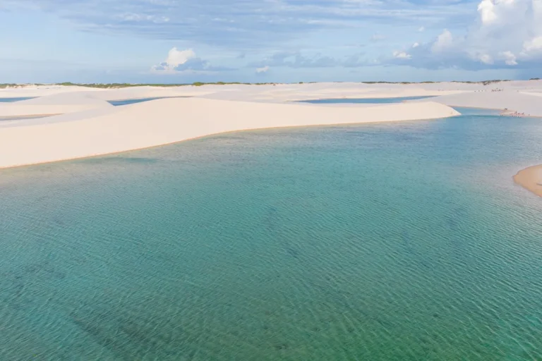
    The lagoon has stretches of calm water, light sand, and areas with hammocks. The scenery changes with the season, rainfall, and wind; don’t count on the same depth or color every day.

    Lagoon surrounded by dunes in Ceará
    Lagoon and dunes in Ceará. | Photo: Renato Nascimento / Pexels

    How to get there

    From Jeri, access is by buggy, safari truck, or 4×4. The east coast buggy tour combines the lagoon with other stops.

    What to combine

    Combine it with Pedra Furada, Árvore da Preguiça, and other lagoons on the east coast. Don’t book tight schedules: travel on sand depends on the weather and the tide.

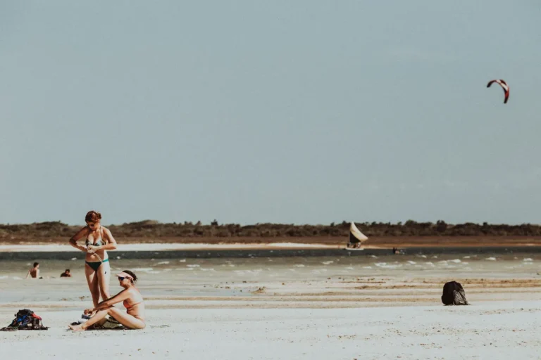
    Jericoacoara beach
    Beach in Jericoacoara. | Photo: Jonathan Borba / Pexels

    Frequently asked questions

    Do you need a buggy?

    Yes, it’s usually the most practical way from Jericoacoara.

    Can you go with kids?

    Yes, just watch out for the sun and the water depth.

    In July 2026, confirm the weather, local rules, and tour conditions before heading out.

    Also check the guidelines from the Ministry of Tourism and the related guide from Voyage Voyage.

    Does the tour depend on the weather?

    Yes. Confirm the forecast, access, and conditions with the operator on the day.

    Conclusion

    Lagoa do Paraíso is worth the trip when you pick your spot well and leave some buffer for travel time.

  • Beach Park: Tickets and Smart Planning

    Beach Park: Tickets and Smart Planning

    🇧🇷 POR | 🇫🇷 FR | 🇺🇸 EN | 🇪🇸 ES

    Beach Park is an entertainment complex in Aquiraz, in the Fortaleza metropolitan area, featuring a water park, beach, and resorts. To avoid surprises, check the operating calendar, buy tickets through the official channel, and set aside a full day.

    Attractions and hours are subject to change; confirm operations before you travel.

    What to do at Beach Park

    The park features water attractions for different adrenaline levels, kids’ areas, and relaxation spots. Read the height and safety rules before getting in line and tackle the most popular rides first.

    Beach on the coast near Fortaleza
    Ceará coastline near Fortaleza. | Photo: Fernando B M / Pexels

    Tickets and visit time

    Prices vary by date and ticket type. Don’t guess the price: check the official page and see if the ticket includes all the areas you want. The Beach Park ticket with transportation can make the day trip easier.

    Getting there

    From Fortaleza, car, transfer, and tour are the most practical options. Arrive before opening and bring your swimsuit, flip-flops, and sunscreen.

    Sea on the Fortaleza coast
    Sea on the Fortaleza coast. | Photo: Vitor Milanez / Pexels

    Frequently asked questions

    Is Beach Park in Fortaleza?

    It’s in Aquiraz, near Fortaleza.

    How much time should I plan for?

    A full day is usually the most comfortable option.

    In July 2026, check the weather, local rules, and tour conditions before heading out.

    Also check the guidelines from the Ministry of Tourism and the related guide from Voyage Voyage.

    Does the tour depend on the weather?

    Yes. Confirm the forecast, access, and conditions with the operator on the day.

    Conclusion

    With the calendar and tickets confirmed, Beach Park works great as the main day of your itinerary.

  • Praia do Futuro: Beach Huts and Ocean in Fortaleza

    Praia do Futuro: Beach Huts and Ocean in Fortaleza

    🇧🇷 POR | 🇫🇷 FR | 🇺🇸 EN | 🇪🇸 ES

    Praia do Futuro is the stretch of sand in Fortaleza known for its well-equipped beach huts, open ocean, and plenty of space to spend the day. The best plan is simple: arrive early, pick a reliable beach hut, and check the sea conditions.

    The open ocean demands attention to the flags and the lifeguards’ guidance.

    What is Praia do Futuro like?

    It’s a long urban beach with wide sand and beach huts offering tables, showers, meals, and family-friendly amenities. The sea can have strong waves, so swimming conditions vary depending on the stretch and the day.

    Praia do Futuro shoreline in Fortaleza
    Fortaleza’s coastline. | Photo: Vitor Milanez / Pexels

    How to choose a beach hut

    Compare location, minimum consumption, parking, and rules for using loungers. On weekends and holidays, arrive early. To explore other spots, check out the Fortaleza itinerary.

    How to get there

    The beach is east of the city center and accessible by ride-hailing app, taxi, or car. Don’t leave valuables visible in your vehicle and check the water quality before going in.

    Beach on the Fortaleza coast
    Beach on the Ceará coast. | Photo: Fernando B M / Pexels

    Frequently asked questions

    Is Praia do Futuro good for kids?

    Yes, with supervision and by choosing a stretch designated for swimming.

    What’s the best time to go?

    Morning for the beach and late afternoon for a walk, depending on the weather.

    In July 2026, confirm the weather, local rules, and tour conditions before heading out.

    Also check the guidelines from the Ministry of Tourism and the related guide from Voyage Voyage.

    Does the tour depend on the weather?

    Yes. Confirm the forecast, access, and conditions with the operator on the day.

    Conclusion

    Praia do Futuro is the practical choice for a day of sea and amenities in Fortaleza.

  • Praia da Pipa: Beaches, Tides, and the Best Home Base

    Praia da Pipa: Beaches, Tides, and the Best Home Base

    🇧🇷 POR | 🇫🇷 FR | 🇺🇸 EN | 🇪🇸 ES

    Praia da Pipa combines cliffs, warm-water bays, and a lively village center packed with restaurants. To make the most of it, you’ll need to decide between staying in the center, close to the action, or using Pipa as a base to explore nearby beaches.

    Low tide changes access to some beaches and natural pools; check the tide table before planning your day.

    Things to do at Praia da Pipa

    Walk along Baía dos Golfinhos when the tide allows, explore Praia do Madeiro, and save time for the Chapadão lookout point. The village center is packed with accommodations, shops, and restaurants, but the distances to the beaches require some stamina or a ride.

    Aerial view of Praia da Pipa
    Praia da Pipa seen from above. | Photo: Isabel ph / Pexels

    How to get there

    Pipa is located in Tibau do Sul, south of Natal. You can get there by car, transfer, or tour. The tour to the beaches of Pipa from Natal takes care of the logistics for a day trip.

    When to go

    Drier months usually favor beach and hiking days, but the forecast and tides are decisive. To enjoy the village center at night, stay at least two nights; a day trip gives you less beach time.

    Cliffs at Praia da Pipa
    Cliffs along the Pipa coastline. | Photo: Thiago Santos / Pexels

    FAQ

    Is Pipa good for a day trip?

    It’s possible, but staying in the village lets you enjoy the beaches and nightlife without rushing.

    Do you need a car?

    Not necessarily; there are transfers, taxis, and tours.

    In July 2026, confirm the weather, local rules, and tour conditions before heading out.

    Also check the guidelines from the Ministry of Tourism and the related guide from Voyage Voyage.

    Does the tour depend on the weather?

    Yes. Confirm the forecast, access, and conditions with the operator on the day.

    Conclusion

    Pipa works best when you have time to alternate between beaches, tides, and the village center.

  • Genipabu Dunes: Buggy Rides and Lagoons, Done Right

    Genipabu Dunes: Buggy Rides and Lagoons, Done Right

    🇧🇷 POR | 🇫🇷 FR | 🇺🇸 EN | 🇪🇸 ES

    The Genipabu Dunes are one of the easiest excursions to fit into a Natal itinerary: you get shifting dunes, lagoons, and a buggy route that can be as thrilling or as mellow as you like. The exact route depends on the wind, the tide, and your starting point.

    During high season, book your buggy in advance and confirm whether the tour includes the ferry crossing.

    What are the Genipabu Dunes like?

    Genipabu sits on the northern coast of Rio Grande do Norte, about 25 km from Natal. The tour crosses dunes, beach areas, and lagoons, with stops for photos and a swim depending on the package you book.

    Genipabu Dunes in Natal
    Genipabu Dunes. | Photo: Alex Dos Santos / Pexels

    Buggy with or without thrills?

    With thrills means steeper drops and sharper inclines; without thrills prioritizes the scenic ride. Tell your buggy driver your comfort level, check their credentials, and ask what’s included. The Genipabu tour from Natal is a practical option.

    How to get there

    You can book a transfer from Natal, drive yourself, or join a tour. Leave early to enjoy the stops with fewer crowds. Wear light clothing, sunglasses, and sun protection.

    Dunes and ocean in Genipabu
    Dunes and ocean on the Natal coast. | Photo: Andre Dantas / Pexels

    Frequently asked questions

    Is Genipabu close to Natal?

    Yes, the drive along the northern coast usually takes under an hour, depending on traffic.

    Do you have to take a buggy?

    The buggy is the most complete way to explore the dunes, but there are tours with transport and specific stops.

    In July 2026, check the weather, local rules, and tour conditions before heading out.

    Also check the guidelines from the Ministry of Tourism and the related guide from Voyage Voyage.

    Does the tour depend on the weather?

    Yes. Confirm the forecast, access, and conditions with the operator on the day.

    Conclusion

    Genipabu is worth the day trip when you pick your thrill level and confirm the route before you hop on.

  • Nusa Penida: Beaches, Costs, and How to Get There Without the Hassle

    Nusa Penida: Beaches, Costs, and How to Get There Without the Hassle

    🇧🇷 POR | 🇫🇷 FR | 🇺🇸 EN | 🇪🇸 ES

    Nusa Penida’s limestone cliffs, viewpoints, and turquoise waters — the island sits just 45 minutes by boat from Bali and packs some of Indonesia’s most jaw-dropping scenery — limestone cliffs plunging into turquoise sea, snorkeling spots with manta rays, and viewpoints that justify every rupiah spent. If you want to know how to get there, what it’ll cost, and which beaches are actually worth the effort, this guide covers it all with updated prices and the pitfalls tours don’t tell you about.

    Nusa Penida is an island 25 km off Bali’s southeast coast, accessible by fast boats departing from Sanur (IDR 150,000-300,000, 30-45 min). The entrance fee costs IDR 25,000 per adult, and natural attractions are open from 6am to 7pm. Ideally, dedicate 2-3 days to explore the west side beaches (Kelingking, Broken Beach) and east side (Diamond, Atuh) without rushing.

    Entrance fee IDR 25,000 adult / IDR 15,000 child (Aug 2026) — nusapenidatour.org
    Snorkeling permit IDR 100,000 per day (Aug 2026)
    Fast boat (Sanur) IDR 150,000-300,000, one-way, 30-45 min (Aug 2026)
    Attraction hours 6am-7pm, daily (access by natural light)
    Ideal duration 2-3 days (day trip possible, but rushed)
    How to get there Fast boat from Sanur or public ferry from Padang Bai

    How to get to Nusa Penida from Bali?

    The fastest way to reach Nusa Penida is to catch a fast boat from Sanur harbor, about 25 minutes from Bali’s airport. The crossing takes 30-45 minutes and costs between IDR 150,000 and IDR 300,000 per leg (Aug 2026), depending on the operator and the season.

    Aerial view of Kelingking Beach on Nusa Penida, Bali
    Kelingking Beach seen from the viewpoint — Nusa Penida’s most famous postcard shot. | Photo: Marlon Trottmann / Pexels

    The first boats leave around 7:30am and the last ones at 4pm. Book the 7:30am or 8am boat to arrive before 9:30am, when the flood of day-trippers clogs the roads and viewpoints. Buy your ticket in advance during high season (Jul-Aug and holidays) — boats frequently sell out.

    Option Price (Aug 2026) Time Best for
    Fast boat (Sanur) IDR 150,000-300,000 30-45 min most travelers, frequent departures
    Public ferry (Padang Bai) IDR 31,700 60-90 min those bringing a scooter, tight budgets

    The budget alternative is the public ferry from Padang Bai, which costs just IDR 31,700 (Aug 2026) and accepts scooters and cars. The downside: departures at 10am and 2pm with frequent delays, and the trip takes longer. If you’re staying in Ubud or East Bali, Padang Bai is closer than Sanur.

    When you disembark at Toya Pakeh or Sampalan harbor, you pay the island entrance fee on the spot (IDR 25,000 per adult). Bring cash in rupiah — they don’t accept cards. Since 2026, the fee can be purchased online in advance, but the booths on arrival still operate.

    How much does it cost to visit Nusa Penida in 2026?

    A day on Nusa Penida realistically costs between IDR 400,000 and IDR 800,000 per person (roughly $25-50 USD at the Aug 2026 exchange rate), adding up boat, entrance fee, driver, and food. Those doing snorkeling add IDR 100,000 for the Marine Protected Area permit.

    Item Cost (Aug 2026)
    Fast boat round trip (Sanur) IDR 300,000-600,000
    Island entrance fee IDR 25,000
    Bali Tourism Tax (provincial) IDR 150,000 (paid on arrival in Bali)
    Private driver (full day) IDR 400,000-600,000
    Snorkeling permit (MPA) IDR 100,000 per day
    Lunch at a local warung IDR 30,000-60,000

    Real total cost of a day with snorkeling: IDR 855,000-1,385,000 (about $55-90 USD, Aug 2026), including round-trip boat, island fee, driver, marine permit, and lunch. Those booking an all-inclusive day tour from Bali (boat + driver + lunch) pay around IDR 500,000-700,000 — cheaper, but with less flexibility and fixed stops.

    What are the best beaches on Nusa Penida?

    Nusa Penida’s beaches split between the west side (Kelingking, Broken Beach, Angel’s Billabong) and the east side (Diamond Beach, Atuh Beach, Thousand Islands). Most visitors can’t see both sides in a single day because of the rough roads — plan at least one day for each side. If you want to compare with other Southeast Asian islands, check out our guide to the best beaches in Phuket.

    West side — Kelingking Beach, Broken Beach, and Angel’s Billabong

    Kelingking Beach is the most photographed spot in all of Indonesia: a T-Rex-shaped headland with turquoise sea 200 meters below. The viewpoint at the top is accessible to anyone, but hiking down to the beach is another story (more on that in the next section). Broken Beach is a 10-minute drive away and impresses with its natural stone arch over the ocean — there’s no access to the water, but the view makes up for it. Right next door, Angel’s Billabong is a natural pool formed between the rocks, but it’s only safe at low tide — strong waves have already swept tourists off the spot.

    Broken Beach in Nusa Penida with natural stone arch
    The natural arch of Broken Beach — one of Nusa Penida’s most stunning formations. | Photo: Alesia Kozik / Pexels

    East side — Diamond Beach, Atuh Beach, and Thousand Islands

    Diamond Beach has white sand, green-cloaked cliffs, and staircases carved into the rock that lead down to the sand strip. The descent calls for closed-toe shoes — flip-flops slip on wet rocks. The sea often has strong currents, so swimming isn’t always possible. Atuh Beach, right next door, offers better conditions for snorkeling when the tide is calm. From the Thousand Islands Viewpoint lookout, you’ll spot islets that look like mushrooms rising from the sea — it makes for the best photos on the east side.

    Crystal Bay — the best for swimming and snorkeling

    Crystal Bay is the island’s most accessible beach and the only one with decent infrastructure (warungs, loungers, restrooms). The water is calm on most days, and snorkeling in the shallow part already reveals colorful corals and clownfish. It’s also the departure point for boats to Manta Point, where groups of manta rays swim in shallow waters — one of Southeast Asia’s most sought-after dives.

    Can you actually hike down to Kelingking Beach?

    Yes, it’s possible to hike down to the sand at Kelingking Beach, but the trail is steep, lacks railings for most of the way, and demands good physical fitness. The 200-meter elevation drop takes 30-60 minutes to descend and up to 90 minutes to climb back up, with stretches of loose dirt and exposed rocks.

    Diamond Beach in Nusa Penida with white sand and cliffs
    Diamond Beach, on Nusa Penida’s east side — white sand between cliffs. | Photo: Putra Arin Wiratama / Pexels

    Leave before 7 a.m. to beat the heat — the trail is fully exposed to the sun. Bring at least 1 liter of water, wear shoes with good grip, and don’t attempt the descent in flip-flops. Swimming at the beach below is dangerous: currents are strong and there are no lifeguards. Most visitors are perfectly happy with the view from the top lookout, which is spectacular without the risk of the descent.

    How many days should you spend in Nusa Penida?

    The ideal amount of time in Nusa Penida is 2-3 full days. With two days, you can cover the west side (Kelingking, Broken Beach, Angel’s Billabong) in one day and the east side (Diamond, Atuh, Thousand Islands) plus snorkeling on the other. A third day lets you visit Crystal Bay at a relaxed pace, explore the underground temple Goa Giri Putri, and enjoy the sunset without rushing.

    A day trip from Bali is possible but rushed: you arrive around 9:30 a.m., navigate potholed roads to see 2-3 spots, and head back between 3-4 p.m. It works if you just want to see Kelingking from the lookout and Broken Beach, but there’s no time to hike down trails, go snorkeling, or visit the east side. If you’re doing a day trip, booking a tour with snorkeling and transport included makes the most of your time.

    What’s the best time to visit Nusa Penida?

    The dry season between April and October offers clear skies, calm seas for the crossing, and good visibility for diving. July and August are the busiest months, with higher prices on boats and accommodation — May, June, and September strike the balance between good weather and fewer tourists.

    From November to March, monsoons bring heavy rain, rough seas, and frequent fast boat cancellations. Limestone trails get slippery and dangerous. It’s not impossible to visit during this time, but be prepared for delays and limitations — and Angel’s Billabong is off-limits due to wave risk.

    Where to stay in Nusa Penida?

    Most hotels and guesthouses are concentrated in the north of the island, between Toya Pakeh and Sampalan, near the arrival ports. This area has the best selection of restaurants, ATMs, and minimarkets. If you want to stay close to Crystal Bay, there are smaller options on the northwest side — ideal for enjoying the sunset on foot.

    Crystal Bay in Nusa Penida, beach with crystal-clear waters
    Crystal Bay at dusk — Nusa Penida’s most accessible beach with the best facilities. | Photo: Nouman Yousuf / Pexels

    Expect simple accommodations: Nusa Penida has no luxury resorts like Bali. Guesthouses with air conditioning and breakfast run IDR 200,000-500,000 per night (Aug 2026). Wi-Fi works in most places but is slow. If you plan to rent a scooter, ask your host for a recommendation — they usually have contacts with reliable rental shops.

    What nobody tells you about Nusa Penida

    Nusa Penida is not Bali. Infrastructure is basic, roads are narrow and full of potholes, and most tourist accidents involve scooters. These are the gotchas the tours don’t mention:

    • Dangerous roads: loose gravel, steep slopes, and massive potholes make scooter rides a risky adventure. Police fine IDR 1,000,000 for driving without an International Driving Permit with motorcycle endorsement (Aug 2026, source: nusapenidatour.org). Hire a private driver — it costs IDR 400,000-600,000 for a full day and is much safer.
    • ATMs that run out of cash: the 10-15 ATMs concentrated in Toya Pakeh and Sampalan are often empty or reject foreign cards. Withdraw everything you need before leaving Bali.
    • Treacherous ocean currents: most of Nusa Penida’s beaches are NOT safe for swimming. The sea is rough and has already swept tourists away at Angel’s Billabong and Diamond Beach. Crystal Bay and Atuh Beach (at low tide) are the exceptions.
    • No Grab or Gojek: ride-hailing apps don’t work on the island. Your transportation depends on a hired driver or a rented scooter.
    • Trash and plastics: Bali banned single-use plastics under 1 liter, but improper disposal is still visible on some beaches, especially during monsoon season.

    Frequently Asked Questions

    Do I need a visa to go to Nusa Penida?

    Brazilians don’t need a visa to enter Indonesia for trips of up to 30 days. Nusa Penida is part of the province of Bali, so the same entry stamp at Ngurah Rai airport already covers your visit to the island. You just need to pay the Bali Tourism Tax of IDR 150,000 upon arrival in the province (Aug 2026).

    Can you swim at Nusa Penida’s beaches?

    Most of Nusa Penida’s beaches have strong currents and aren’t safe for swimming. Crystal Bay is your best bet for a swim — calm, shallow waters most of the year. Atuh Beach also allows swimming when the tide is low. Kelingking Beach and Diamond Beach are stunning for photos, but the sea there is dangerous.

    Does Nusa Penida have Grab or Gojek?

    Nusa Penida has no coverage from ride-hailing apps like Grab or Gojek. The only way to get around is by renting a scooter (with an International Driving Permit) or hiring a private driver, who charges between IDR 400,000 and IDR 600,000 for a full day (Aug 2026).

    Is Crystal Bay good for snorkeling?

    Crystal Bay is excellent for snorkeling, with preserved coral and visibility of up to 15 meters during the dry months (Apr–Oct). Crystal Bay is also the departure point for boats heading to Manta Point, where you can swim with manta rays in shallow water. The Marine Protected Area permit costs IDR 100,000 per day (Aug 2026).

    Are there ATMs on Nusa Penida?

    Nusa Penida has between 10 and 15 ATMs, concentrated in Toya Pakeh and Sampalan on the north side of the island. The catch is they often run out of cash and many reject international cards. The recommendation is to withdraw all the cash you’ll need before leaving Bali.

    Conclusion

    Nusa Penida delivers beaches you won’t find anywhere else in Southeast Asia — from Kelingking Beach seen from above to snorkeling with manta rays at Crystal Bay. With 2–3 days, a hired driver, and rupiah in your pocket, you’ll enjoy the island without any hassle. If you’re planning a trip to Bali, set aside at least two days to cross the strait and explore Nusa Penida’s beaches on your own. And if your trip includes a stop in Thailand, check out our complete Bangkok itinerary. At VoyageVoyage you’ll find more practical guides to help you plan your Southeast Asia route.

  • Ponta Negra Beach: The Best Home Base in Natal

    Ponta Negra Beach: The Best Home Base in Natal

    🇧🇷 POR | 🇫🇷 FR | 🇺🇸 EN | 🇪🇸 ES

    Ponta Negra Beach is Natal’s main urban beach, with Morro do Careca (the city’s iconic sand dune) as its visual landmark. The neighborhood is packed with hotels, restaurants, and tours, but the experience shifts with the tide, the crowds, and the sea conditions.

    To make the most of it, choose a place to stay near the waterfront and save your beach time for the morning.

    Why visit Ponta Negra?

    It’s the simplest base for a first trip to Natal: you get the sea, the boardwalk, bars, restaurants, and easy access to day trips all in one area. Morro do Careca dominates the landscape, but access to the dune itself is restricted to preserve it.

    Ponta Negra Beach with Morro do Careca in the background
    Ponta Negra and Morro do Careca. | Photo: Ivett M / Pexels

    What to do at the beach

    Walk along the waterfront, pick a spot with amenities, and take in Morro do Careca from the sand. For a different perspective, you can book a boat tour with views of Morro do Careca. At night, the neighborhood comes alive with restaurants and bars.

    How to get there and when to go

    From the airport, the ride depends on traffic; ride-hailing apps, taxis, and transfers are the most practical options. In the morning, the light is great for photos and the heat is usually more manageable. Check the water quality and respect the signs before you go in.

    What to pair with Ponta Negra

    Set aside another day for Genipabu, the southern coast, or Pipa. Voyage Voyage has ideas for planning your trip without cramming all the tours into one day.

    Aerial view of Natal and Ponta Negra Beach
    Aerial view of Natal’s waterfront. | Photo: Renata Lucca / Pexels

    Frequently asked questions

    Can you climb Morro do Careca?

    Access to the dune is restricted; admire the formation from the beach or the sea.

    Is Ponta Negra a good place to stay?

    Yes, especially if you want restaurants and tours nearby.

    What’s the best time to go?

    Morning for the beach and late afternoon for a walk and photos, depending on the weather.

    In July 2026, double-check the tide, water quality, and local rules before heading out.

    Also check the guidelines from the Ministry of Tourism to help plan your visit.

    Conclusion

    Ponta Negra combines an urban beach with easy logistics. Pick a place to stay near the waterfront, respect the protected area around Morro do Careca, and spread out your tours to enjoy Natal at a relaxed pace.

  • Moses Path: How to Time the Tide in Maragogi

    Moses Path: How to Time the Tide in Maragogi

    🇧🇷 POR | 🇫🇷 FR | 🇺🇸 EN | 🇪🇸 ES

    Moses Path is a sandbank that appears on Barra Grande Beach in Maragogi when the tide recedes significantly. The strip lets you walk out into the sea over a shallow stretch, but it disappears as the water rises — which is why timing is an essential part of the experience.

    Never walk all the way to the end without planning your return: the path can become covered quickly.

    What is Moses Path?

    It’s a strip of sand exposed by the low tide at Barra Grande. The landscape changes with the sea level, and the ground can have rocks, shells, and slippery patches. The spot is not a permanent walkway, nor does it guarantee the same width every day.

    Boat in the shallow waters of Maragogi
    Boat in the region’s shallow waters. | Photo: Lucas Meneses / Pexels

    What’s the best tide?

    Look for a very low tide, often indicated by operators as close to 0.2 m, but use the official tide table and local guidance for your travel dates. The lowest tide usually happens within a short window. Start heading back before the minimum point so you don’t depend on the exact moment.

    How to get to Barra Grande

    Barra Grande is on the coast of Maragogi, north of the town center. You can get there by car, taxi, or transfer, and confirm access with your inn. Don’t walk over reef areas and don’t go into water with a current. The article Maragogi in 4 days helps you fit the visit into your itinerary.

    If you want a boat activity, check out the motorized raft tour to Crôa de São Bento.

    What to combine

    Combine it with Barra Grande Beach and, at another tide time, with a natural pool. Avoid booking too many attractions on the same day: Moses Path can appear early and disappear before lunch.

    Natural pools of Maragogi
    Natural pools on the coast of Maragogi. | Photo: Lucas Meneses / Pexels

    Frequently asked questions

    Does Moses Path appear every day?

    It depends on the low tide and may not appear in a walkable form every day.

    Is it safe to walk?

    Only with a low tide, local guidance, and enough time to return.

    Where is it?

    At Barra Grande Beach, in Maragogi.

    In July 2026, confirm the tide, water quality, and local rules before heading out.

    Also check the guidelines from the Ministry of Tourism to plan your visit.

    Conclusion

    Moses Path is a short-window experience. Check the tide, leave extra time for the return, and treat safety as part of the adventure.

  • Maragogi’s Galés: Time Your Visit to the Tide Pools

    Maragogi’s Galés: Time Your Visit to the Tide Pools

    🇧🇷 POR | 🇫🇷 FR | 🇺🇸 EN | 🇪🇸 ES

    The Galés de Maragogi are natural pools formed by the reefs of the Costa dos Corais. The tour only delivers crystal-clear water and fish when the tide is low, so catamaran or raft departures need to be scheduled around that window.

    Don’t book the tour without checking the tide table: high tide can turn the attraction into a regular boat ride.

    What are the Galés de Maragogi like?

    The reefs sit offshore and create shallow pools, usually with calm water at low tide. It’s a tour for observing, floating, and snorkeling; stepping on the coral or removing animals and structures from the bottom is not allowed.

    Natural tide pools in Maragogi seen from above
    Natural tide pools in Maragogi. | Photo: Lucas Meneses / Pexels

    What tide is good for visiting?

    The lower the predicted tide, the better the visibility and the longer you can stay in the pools tend to be. The operator sets the departure time based on the day’s tide. Arrive early, use water-resistant sunscreen, and bring only a few essentials in a waterproof bag.

    For a related tour, check out the option of a motorized raft ride to Crôa de São Bento, which also depends on sea conditions.

    How to get to the Galés

    Departures happen from points along the Maragogi coastline, and the exact boarding spot varies depending on the tour you book. From Maceió, a day trip is possible, but staying overnight in town makes it easier to match the tide. To plan more days, use the Maragogi in 4 days itinerary.

    What to do after?

    Set aside time for Barra Grande beach, the Caminho de Moisés when the tide allows, and Maragogi’s urban stretch. Have lunch before or after boarding, as the boat schedule can take up the best part of the day.

    Colorful boat on the waters of Maragogi
    Boat on the waters of Maragogi. | Photo: Lucas Meneses / Pexels

    Frequently asked questions

    Are the Galés open every day?

    The tour depends on the tide, the weather, and the conditions authorized for navigation.

    How long does it last?

    It varies by operator and tide; confirm before booking.

    Can I bring children?

    Yes, with supervision and a life jacket when recommended.

    In July 2026, confirm the tide, water quality, and local rules before heading out.

    Also check the guidelines from the Ministry of Tourism to plan your visit.

    Conclusion

    The Galés are worth the trip when the tide favors the tour. Plan the tide table first, then transportation and accommodation.

  • Ponta Verde Beach: Best Time to Visit and Tips

    Ponta Verde Beach: Best Time to Visit and Tips

    🇧🇷 POR | 🇫🇷 FR | 🇺🇸 EN | 🇪🇸 ES

    Ponta Verde Beach is the most convenient stretch of Maceió’s coastline for anyone looking to mix swimming, walking, dining, and photos all in one day. The scenery changes dramatically with the tide: the lighthouse and reefs become more accessible when the water recedes.

    To walk out to the lighthouse, check the tide and start heading back before the water rises.

    Why visit Ponta Verde Beach?

    Ponta Verde combines an urban stretch of sand, a boardwalk, bike lane, kiosks, and hotels. It’s a great base for a first trip to Maceió because you can walk out for meals, photograph the coastline, and reach Pajuçara without needing a car.

    Colorful boats on Ponta Verde Beach in Maceió
    Boats along the Ponta Verde shoreline. | Photo: Rodrigo Fonseca / Pexels

    What to do in Ponta Verde

    Walk along the boardwalk, stop at Marco dos Corais, and take in the lighthouse from the sand. At low tide, some visitors venture out across the shallow stretch, but the ground can be uneven and slippery. For swimming, stick to monitored areas and check the water quality.

    The neighborhood also works as a launch point for experiences along the coast. If you want to mix things up, you can book a boat tour of the Nine Islands.

    What’s the best time to visit?

    Early morning usually brings soft light and fewer crowds; late afternoon is great for a walk and sunset. For the lighthouse and the shallow natural pools, the deciding factor is low tide, not just the clock. On days with rough seas, don’t go near the reefs.

    How to get there and where to stay

    Ponta Verde sits between Pajuçara and Jatiúca. From other parts of Maceió, a ride-hailing app or taxi will get you there; if you’re staying right on the shore, you can do almost everything on foot. To decide on your base, compare the area with options for where to stay in Porto de Galinhas if your trip includes Pernambuco.

    Aerial view of the Maceió coastline
    Maceió’s urban shoreline. | Photo: Constantino Filmes / Pexels

    Frequently asked questions

    Is Ponta Verde good for swimming?

    Yes, but check the water quality and sea conditions on the day.

    Can you walk to Pajuçara?

    Yes, the stretches are close along the shore, making for an easy urban walk.

    When is the lighthouse visible?

    It’s more accessible both visually and on foot during low tide.

    In July 2026, confirm the tide, water quality, and local rules before heading out.

    Also check the guidelines from the Ministry of Tourism to help plan your visit.

    Conclusion

    Ponta Verde is a safe bet for organizing days without long commutes: beach, walking, and restaurants are all concentrated along the shore. Check the tide and water quality before getting in the sea.