Category: Beaches & Nature

  • Things to Do in Alter do Chão: When the Beach Appears

    Things to Do in Alter do Chão: When the Beach Appears

    🇧🇷 POR | 🇫🇷 FR | 🇺🇸 EN | 🇪🇸 ES

    Alter do Chão sits about 35 km from Santarém, in western Pará, and is known as the “Caribbean of the Amazon” for its clear Rio Tapajós waters and the white sands of Ilha do Amor.

    Things to do in Alter do Chão boil down to three main experiences: hopping on a little boat to Ilha do Amor, hiking up Serra da Piraoca for a bird’s-eye view of the village, and taking a speedboat through the igarapés (flooded forest channels) to riverside communities along the Tapajós. You can cover the essentials in 3 days, but when you go changes everything—the beaches only appear when the river drops, between August and December.

    How to get to Alter do Chão

    There are no direct flights to Alter do Chão: the gateway is Santarém International Airport – Maestro Wilson Fonseca, with regular connections from Belém and other Brazilian capitals. From the runway to the village it’s about 35 km, a 40-to-50-minute drive on paved roads—much shorter than the trek to other isolated beach destinations like Fernando de Noronha.

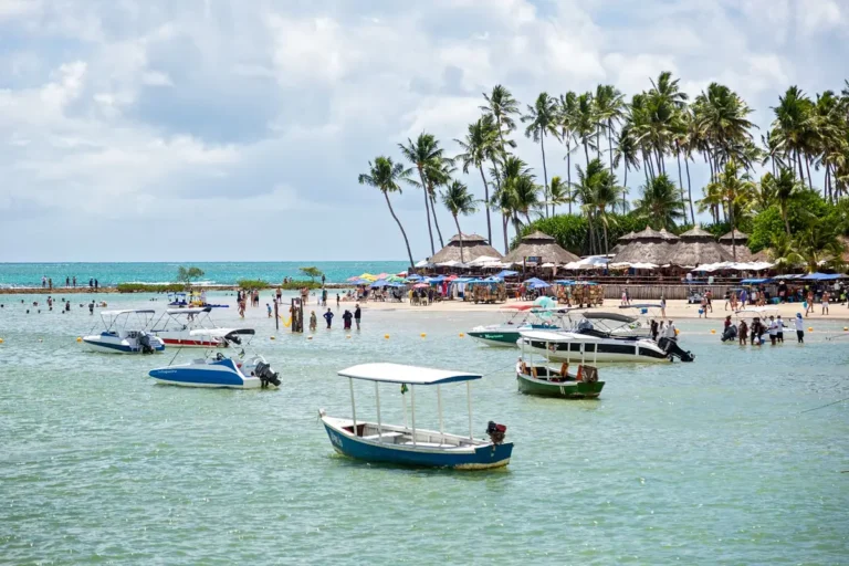
    White sand beach and clear water at Ilha do Amor in Alter do Chão
    The crossing to Ilha do Amor is made by boat from the village waterfront. | Photo: Lucia Barreiros Silva / Pexels

    At the airport, your options are taxis (pricier, but direct to your guesthouse) or vans and buses running the Santarém–Alter do Chão route, which also leave from downtown Santarém throughout the day. Confirm the time of the last transport of the day before heading out at night, because options drop off significantly after 7 p.m.

    If you’d rather not depend on a fixed van schedule, you can book a private transfer straight from the airport to your guesthouse—more expensive, but with no waiting and door-to-door luggage service. Taxis usually wait right outside the airport and negotiate the fare before you leave; it’s worth agreeing on a price in advance, since there’s no regulated meter for this route. For those arriving by riverboat from Belém or Manaus, you’ll disembark at the port in Santarém, then continue by car or van to Alter do Chão along the same 35 km stretch.

    Best time to visit and how long to stay

    The best time to visit Alter do Chão runs from August to December, the so-called Amazonian summer, when the Rio Tapajós level drops and reveals the white-sand beaches, including Ilha do Amor. The rest of the year, with the river high, the island stays submerged—but it’s precisely that period, from January to July, that’s best for boat tours through the igarapés and access to flooded forest areas (reference data Jul/2026, according to local operators).

    To comfortably explore the essentials—Ilha do Amor, Serra da Piraoca, and a boat ride on Lago Verde—plan for 3 to 4 days. If you want to add a longer excursion along the Rio Tapajós or Rio Arapiuns, visiting more remote riverside communities, tack on 2 to 5 extra days, depending on the itinerary you choose.

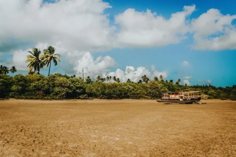
    Boats anchored along the shores of Lago Verde in Alter do Chão
    Fishing boats and tour boats share the shoreline of Lago Verde. | Photo: Jose Hilton Pereira da Silva / Pexels

    What to see in Alter do Chão

    The village is small, but its attractions each deserve about half a day—you can easily pair two in a single day without rushing, a pace that’s a far cry from bigger destinations like Armação dos Búzios.

    Ilha do Amor

    It’s the postcard image of Alter do Chão: a tongue of white sand separating Lago Verde from the Rio Tapajós, visible right from the village waterfront. Little boats make the crossing straight from the main beach, with a reference price of around R$ 10 per person (Jul/2026), subject to change based on demand and season. You can only walk over to the island during the dry season, between August and December; the rest of the year, it disappears beneath the water.

    Serra da Piraoca

    At about 110 meters tall, it’s the highest point in Alter do Chão and offers the most complete view of the village, the meeting of the rivers, and Ilha do Amor down below. The access trail takes about 60 minutes to climb, with no guide needed if you have basic fitness, but closed-toe shoes help a lot on the loose-rock final stretch.

    Sunset seen from the Rio Tapajós near Alter do Chão
    The evening over the Tapajós is one of the most sought-after experiences for those staying in the village. | Photo: Eduardo Amorim / Pexels

    Boat tour on Lago Verde and the igarapés

    Speedboats leave from the waterfront on half-day or full-day routes to spots like Ponta do Cururu, Ponta de Pedras, and Lago Verde itself. The average cost runs between R$ 150 and R$ 250 per person (Jul/2026), dropping significantly with a larger group—it’s worth negotiating directly with the boatmen on the shore or booking through a local agency, according to recent traveler reports (source: Mala de Aventuras).

    The quick crossing to Ilha do Amor goes for about R$ 5 per boat, a fare that can be split among up to five people—the cheapest option if you just want to spend the day on the beach. Full-day Lago Verde itineraries usually include a swim stop at less crowded beaches and a chance to spot pink river dolphins at specific points on the river, depending on the season. Booking through your guesthouse or directly on the waterfront the night before guarantees a spot without having to line up at dawn for the boats.

    What to pair with Alter do Chão

    Travelers with extra days often add a multi-day excursion along the Rio Tapajós or Rio Arapiuns, visiting riverside communities and stretches of preserved forest—a way to step off the beach circuit and see the region’s daily life up close. Booking this kind of tour in advance keeps you from missing out during high season, the same caution that applies to more crowded beach itineraries like Porto de Galinhas.

    You can also book the full Alter do Chão tour with a local guide, a great option if you’d rather not organize every leg on your own.

    Where to eat

    The village lives on fresh river fish—tucunaré, tambaqui, and pirarucu show up on most menus, usually grilled or prepared caboclo-style with tucupi sauce and jambu. Restaurants are concentrated on the main street and along the waterfront, with individual dishes running between R$ 40 and R$ 70 (Jul/2026). For a quick bite between outings, the waterfront stalls serve freshly blended açaí and stuffed tapioca.

    It’s worth setting aside one night to experience riverside cuisine in a more elaborate form, with dishes like maniçoba and duck in tucupi sauce at restaurants that work by order — you usually need to give a few hours’ notice. Travelers with dietary restrictions will find fewer options outside the fish-and-açaí circuit, so it’s worth checking with your pousada which places have vegetarian alternatives before locking in your meal plan.

    Where to Stay

    Those who prioritize quick access to the beach and nightlife look for pousadas on the main street, just steps from the ferry to Ilha do Amor. Those who want peace and quiet with a river view will find options further from the center, usually at a slightly lower price and requiring your own transport to get back and forth at night. Booking 2 to 3 months in advance is recommended for trips between August and December, when demand skyrockets.

    Riverside community houses along the banks of a river in the Amazon
    Riverside communities along the Tapajós welcome visitors on day trips or longer stays. | Photo: Franklin Peña Gutierrez / Pexels

    Practical Tips

    Bring sunscreen and insect repellent — the village has little shade along the waterfront, and mosquitoes come out at dusk. ATMs are scarce: withdraw cash in Santarém before heading out, because not every establishment accepts cards. Internet signal is unstable outside the main street, so download offline maps in advance. The yellow fever vaccine is recommended for anyone traveling to the Amazon region — check the expiration date before you fly, as advised by the Ministry of Health.

    Travelers who make it to Alter do Chão often include Belém in their itinerary, whether as a gateway or a final stop — the capital of Pará has the Ver-o-Peso Market and Amazonian cuisine that are worth at least 3 days of your time.

    Frequently Asked Questions

    How many days do you need to explore Alter do Chão?

    To see the essentials of Alter do Chão — Ilha do Amor, Serra da Piraoca, and a boat trip on Lago Verde — 3 to 4 days are enough. If you want to include a longer excursion along the Tapajós or Arapiuns rivers, add extra days to your itinerary.

    What’s the best time to see the beaches of Alter do Chão?

    The beaches of Alter do Chão, including Ilha do Amor, are only visible between August and December, when the Tapajós River level drops. The rest of the year the river rises and covers the sand, but that’s actually a great time for boat trips through the igarapés (flooded forest channels).

    How do I get from Santarém airport to Alter do Chão?

    The route from Santarém International Airport to Alter do Chão is about 35 km and takes 40 to 50 minutes by car, taxi, or van. Vans and buses also leave from downtown Santarém throughout the day.

    Is Alter do Chão safe for solo travelers?

    Alter do Chão is an established tourist destination and frequently welcomes solo visitors. The basic precautions are the same as for any trip: avoid walking down empty streets at night, keep your documents and cash in a safe place, and confirm transport schedules in advance.

    Conclusion

    Alter do Chão delivers freshwater beaches, forest, and riverside culture just a few kilometers from Santarém, but the itinerary changes completely depending on the month you travel — so plan your dates around the river level before booking your ticket. For more destinations like this, Voyage Voyage has guides to beaches and nature spots all across Brazil.

  • Playa del Carmen: Cenotes, Beaches, and Mayan Adventures

    🇧🇷 POR | 🇫🇷 FR | 🇺🇸 EN | 🇪🇸 ES

    Playa del Carmen is one of the most practical bases in the Riviera Maya: you sleep near the sea, stroll along Fifth Avenue, and can head out early to cenotes, Cozumel, Tulum, or Chichén Itzá. The city also has a lively nightlife scene, so choosing the right hotel area matters just as much as deciding which tours make your itinerary.

    For a first visit, plan on 4 to 6 days. That gives you time to separate beach and city time from longer excursions, so you’re not racing to the next landmark every single morning.

    How to get to Playa del Carmen

    The most common airport is Cancún International Airport (CUN), about 55 to 60 km from Playa del Carmen, depending on your final destination. From there, you can take the ADO bus, a shared shuttle, or a private transfer. The bus is usually the simplest option if you’re staying near the Fifth Avenue bus terminal; with luggage, kids, or a late-night arrival, a pre-booked transfer might be more comfortable.

    Cenote surrounded by vegetation in the Playa del Carmen area
    A cenote in the Playa del Carmen area. | Photo: Annalise Tingler / Pexels

    Downtown is fairly compact, and Fifth Avenue is easy to explore on foot. For more distant beaches, grab a taxi or local transport. The ferry to Cozumel leaves from the center and makes a day trip easy, but check the official schedules that day, since wind and sea conditions can change operations.

    Best time to visit and how many days to stay

    From November to April, you’ll typically get drier days and pleasant temperatures. December and January are busy; May and June can be hotter and more humid. Between June and October, check the rain forecast and sea conditions. Sargassum seaweed on the beaches varies by stretch and season, so don’t book your trip expecting one perfect beach the whole time.

    With four days, plan one day for the city and beach, one cenote or Cozumel trip, and one day for Tulum or another Mayan site. With six days, you can add Chichén Itzá without sacrificing downtime. Long archaeological tours mean leaving before sunrise, so don’t pair them with a late night out beforehand.

    What to see and do in Playa del Carmen

    Fifth Avenue and Parque Fundadores

    Fifth Avenue is packed with shops, restaurants, bars, and tour agencies, but it’s not the only interesting part of town. Walk over to Parque Fundadores and the waterfront, and notice how the center’s vibe shifts as you move away from the busiest blocks. At night, things pick up; if you prefer an early bedtime, pick a hotel a few streets inland or outside the loudest stretch.

    Set aside one morning for a walk with no shopping agenda. Cafés, craft shops, and small restaurants pop up on the side streets. For souvenirs, compare prices and ask about payment options before you commit.

    Visitors in front of El Castillo at Chichén Itzá, Mexico
    El Castillo at Chichén Itzá. | Photo: Dmitriy Piskarev / Pexels

    Beaches and the Caribbean Sea

    Playa Mamitas is known for its beach club scene and lively atmosphere. For a quieter spot, check out Playacar, Punta Esmeralda, or stretches further south, always respecting private areas and sea conditions. The water can be stunning, but sargassum changes the experience; have a backup plan like a pool, a cenote, or a cultural tour.

    If you want to dive or snorkel, Cozumel is a natural pick. Head out early, give yourself buffer time for the ferry, and don’t book a flight on the same day as a dive. Biodegradable sunscreen may be required at cenotes and natural areas.

    Cenotes and nature experiences

    Cenotes are freshwater sinkholes formed in the peninsula’s limestone. Some are dark caves, while others have wide openings and blue-tinted water. Bring quick-dry clothes, a compact towel, and cash for entry fees; at many spots, lockers, life vests, and food are charged separately.

    Pick a cenote that fits your comfort level: open ones work best if you’re nervous about enclosed spaces, while underground ones are more exciting for a true cave experience — our guide to Mexico’s cenotes with a focus on safety breaks down each type and the risks involved. Skip repellent or oils before entering the water if the site bans them.

    Tours to combine with the city

    Tulum is the easiest day trip to fit in, especially if you leave early and pair the ruins with a beach or cenote. Our Tulum guide helps you plan that day. Chichén Itzá is a longer drive but worth it if you want to see one of Mexico’s most important archaeological sites; check out our complete Chichén Itzá guide and the INAH info on the Tulum archaeological zone.

    For a day on the water, Cozumel is the obvious pick. For ruins and fresh water in one outing, look for tours that bundle Tulum with a cenote, and double-check exactly what’s included in the price. Compare the Chichén Itzá and Tulum tour from the Riviera Maya before booking: it’s a long day, so make sure it fits your pace. For destination info, also check the official Visit Mexico page on Playa del Carmen.

    Mayan temple at Tulum on Mexico's coast
    The Mayan ruins of Tulum. | Photo: Paco de Bydzia / Pexels

    If you want to expand your circuit, use Chichén Itzá from Cancún as a reference for timing and crowds. Don’t try to squeeze Tulum, Chichén Itzá, and Cozumel into one day: the distances and transport schedules will wear you out.

    Where to eat

    Playa del Carmen’s food scene goes way beyond Fifth Avenue. Try tacos al pastor, cochinita pibil, ceviches, and corn-based dishes at taquerias and restaurants where locals eat. In the tourist zone, prices climb; check the menu before you sit down and ask if the service charge is included.

    For dinner, book ahead at popular spots. At lunch, pick a busy place, especially for seafood. Markets and convenience stores are great for a quick breakfast before those sunrise departures.

    Where to stay in Playa del Carmen

    The Centro is best for those who want to do almost everything on foot, hit the nightlife, and catch the ferry without relying on a car. Playacar has a more residential, resort-style vibe with beaches and green areas, but you might need a taxi to get back to the center. The Coco Beach area offers modern hotels and ocean access, though it’s farther from the bus station.

    Check noise reviews before booking. Nightclubs and bars can keep the music loud until late. Also check whether the beach near your hotel is public, if there’s a resort fee, and how much transportation to the tour departure points will cost.

    Practical Tips

    Use Mexican pesos for small purchases, tips, and transportation. Cards are common at hotels and restaurants, but don’t rely on them at cenotes or beach stalls. Bring insect repellent for jungle areas, a hat, a reusable water bottle, and a bag that can get wet.

    On archaeological tour days, head out early and wear comfortable shoes. For cenotes, follow the swimming rules and don’t apply any products to your skin before entering. Brazilians should check the entry documents and requirements for Mexico on official sources before boarding.

    El Castillo pyramid at Chichén Itzá
    El Castillo pyramid at Chichén Itzá. | Photo: Steven Skelley / Pexels

    Frequently Asked Questions

    How many days should I spend in Playa del Carmen?

    Four to six days lets you mix city time, beach days, a cenote, and one or two longer excursions.

    Which airport should I use for Playa del Carmen?

    Cancún International Airport is the main gateway, with buses, shuttles, or private transfers to the city.

    Playa del Carmen or Cancún?

    Playa del Carmen is more compact and makes it easy to combine cenotes, Cozumel, Tulum, and Chichén Itzá. Cancún has a more spread-out hotel zone and massive resorts.

    Is it safe to walk along Quinta Avenida at night?

    The area is lively, but keep your wits about you, avoid deserted streets, and use official transportation when you’re far from your accommodation.

    Conclusion

    Playa del Carmen works best when you split your trip between beach days and road-trip days. Choose a stay that matches your sleep style, have a backup plan for sargassum, and book the most popular tours in advance. On Voyage Voyage, you’ll find more Mexico itineraries to put together your full trip.


  • Puerto Vallarta: Beaches, Tours, and Tips Without the Rush

    Puerto Vallarta: Beaches, Tours, and Tips Without the Rush

    🇧🇷 POR | 🇫🇷 FR | 🇺🇸 EN | 🇪🇸 ES

    Puerto Vallarta pairs a stretch of open ocean with the Sierra Madre mountains and a historic center that’s still a joy to explore on foot. In just a few days, you can mix beach time, tacos, galleries, hikes, and a boat trip to Los Arcos without turning your vacation into a sightseeing sprint. The trick is picking the right home base and booking your boat excursions a bit in advance.

    For a first visit, plan on 4 to 5 days: two for the center and the city beaches, one for Los Arcos or another cove, and one flexible day for food, shopping, or a more distant beach.

    How to get to Puerto Vallarta

    Puerto Vallarta International Airport (PVR) handles domestic and international flights and sits north of the urban area. The official Puerto Vallarta tourism guide notes that the airport is one of the region’s main gateways. From the terminal to downtown or the Zona Romántica, consider a pre-booked shuttle, an authorized taxi, or a ride-hailing app, depending on where pickups are allowed that day.

    Beach and hotels on the coast of Puerto Vallarta, Mexico
    Beach and hotels on the coast of Puerto Vallarta. | Photo: Jeffrey Eisen / Pexels

    If you land during peak hours, the drive can take longer due to traffic on the coastal avenue. If you’re arriving tired or traveling with kids, it’s worth arranging your shuttle ahead of time. Downtown, many attractions are close together, and you can cover a good chunk of your itinerary on foot; for southern beaches and boat trips, use a taxi, an app, or the operator’s transfer service.

    Best time to visit and how many days to stay

    From November to April, the weather tends to be drier and more comfortable for the beach, hiking, and boat tours. December, January, and March usually see the highest demand, while summer is more humid and can bring afternoon showers—but also lush scenery and lower rates. Between July and September, check the forecast before booking any maritime excursion.

    With three days, focus on the center, the Malecón, the Zona Romántica, and one boat trip. Four or five days let you add a southern beach, a long, leisurely meal, and a day with no agenda at all. A full week makes sense if you want to explore Sayulita, San Pancho, or the Bahía de Banderas region at a relaxed pace.

    What to see and do in Puerto Vallarta

    Malecón and Historic Center

    Start at the Malecón in the late afternoon, when the seaside sculptures take on a new character and the light turns softer. Walk over to Plaza de Armas and then wander the cobblestone streets of the center. The official attractions list highlights the Malecón and the Cuale River Island as key spots in the local cultural scene.

    Detour to the Church of Our Lady of Guadalupe, browse the galleries, and cross the bridge to Cuale Island. The island’s market is great for crafts and souvenirs, but compare prices before you buy. At night, the Zona Romántica is packed with bars, restaurants, and a pleasant stroll near Los Muertos beach.

    Beach at dawn in Puerto Vallarta, Mexico
    Beach at dawn in Puerto Vallarta. | Photo: Elmira Danilova / Pexels

    City and southern beaches

    Playa Los Muertos is the most convenient option if you’re staying in the Zona Romántica: it has restaurants, loungers, and plenty of buzz. For a quieter setting, check out Conchas Chinas, with its small coves and rocky outcrops, or take a trip to Mismaloya. The water and the sand vary a lot from beach to beach, so don’t expect the same calm Caribbean-style sea you’d find at a resort.

    The trip to Los Arcos is one of the bay’s classics. The cluster of rock formations can be seen from a boat and, on the right tours, is combined with snorkeling or a beach stop. Book the Los Arcos catamaran excursion if you’d rather have transport and gear sorted out for you.

    The sea can get choppy in the bay, so bring motion sickness meds if you tend to feel queasy on boats.

    Viewpoints, sunsets, and nature

    Climb up to the Mirador de La Cruz for a sweeping view of the city, the bay, and the mountains. The staircase takes some effort, especially in the heat, so go early or late in the day. Another option is to wander along the Cuale River and hunt for small cafés and galleries away from the main drag.

    View of the bay and hotels in Puerto Vallarta, Mexico
    View of the bay and hotels in Puerto Vallarta. | Photo: Andrew Patrick Photo / Pexels

    What to combine in the surrounding area

    Sayulita and San Pancho lie to the north and offer a different vibe, with smaller streets, surfing, and laid-back restaurants. The trip eats up a good chunk of the day, so avoid pairing both villages with a boat tour. To the south, Mismaloya and Boca de Tomatlán are closer alternatives for seeing the transition from city to jungle.

    If you prefer nature, set aside a day for a beach accessible only by boat, like Yelapa or Majahuitas. Check the departure point and return time: on rough-sea days, the experience can change. Bring cash for small purchases and sun protection.

    Where to eat in Puerto Vallarta

    For great food, don’t limit yourself to the waterfront restaurants. Wander through the center and the Zona Romántica in search of tacos, seafood, birria, and dishes made with local ingredients. Dinner tends to cost more on the busiest streets; at lunch, set menus and taquerias usually offer better value.

    Only order seafood at places with high turnover, and confirm whether the price is per portion or by weight. At beach bars, ask upfront about minimum consumption, chair rentals, and service fees. A tequila tasting or a cooking class can fill a rainy evening and bring you closer to Jalisco’s food culture.

    Where to stay

    The center is ideal if you want to walk to the Malecón, restaurants, and historic sights. The Zona Romántica has nightlife, a nearby beach, and tons of apartment rentals. Marina Vallarta offers easy airport access and resort-style hotels, but it’s farther from downtown. In the southern area, you get scenery and peace and quiet, with less convenience for exploring on foot.

    When choosing a place to stay, check beach access, how steep the streets are, whether there’s air conditioning, and the real distance to your tour departure point. Puerto Vallarta’s neighborhoods differ a lot; a cheap hotel far from your itinerary can cost you time and transport every single day.

    Practical tips for making the most of your trip

    The currency is the Mexican peso. Cards work at hotels and restaurants, but keep smaller bills for transport, markets, and tips. Use biodegradable sunscreen when the operator or the natural area requires it, and don’t touch corals or wildlife while snorkeling.

    Confirm schedules, tides, and cancellation policies the day before your boat tours. Whale season usually falls during the cooler months, but sightings are never guaranteed. Brazilian travelers should check entry requirements, documents, and any health rules directly with official sources before the trip.

    People on the beach during sunset in Puerto Vallarta
    Sunset in Puerto Vallarta. | Photo: David Rios / Pexels

    Frequently Asked Questions

    What is the best time to visit Puerto Vallarta?

    From November to April, when the weather tends to be drier. Summer is more humid, but you may find lower prices and greener vegetation.

    How many days are enough in Puerto Vallarta?

    Four or five days let you explore downtown, hit the beaches, and take a boat tour without rushing.

    Does Puerto Vallarta have good beaches?

    Yes. Los Muertos is convenient and lively; Conchas Chinas, Mismaloya, and boat-only beaches offer different vibes.

    Can you explore Puerto Vallarta without a car?

    Yes. Downtown and the Zona Romántica are walkable; for farther beaches and tours, use a taxi, ride-hailing app, or transfer.

    Conclusion

    Puerto Vallarta works for anyone who wants to combine sea, food, and city life in a single trip. Set up your base according to your pace, book a boat excursion, and leave room to wander downtown without a plan. At Voyage Voyage, you’ll find more guides to help plan your trip through Mexico.


  • Punta Cana Without the Pitfalls: Resorts and Tours Worth It

    Punta Cana Without the Pitfalls: Resorts and Tours Worth It

    🇧🇷 POR | 🇫🇷 FR | 🇺🇸 EN | 🇪🇸 ES

    Punta Cana isn’t a destination you can sum up with a single resort photo. The region boasts beaches with different vibes, hotels that are far apart from each other, and tours that require a full day away from your property. Choosing the right area before you pay can completely change your trip.

    Punta Cana is most rewarding when you combine a great resort with two or three days of beach time and excursions, rather than trying to see everything in a short stay. For travelers from Brazil, the easiest route is flying into Punta Cana International Airport (PUJ), booking your transfer, and deciding if your priority is calm water, nightlife, or tours like Isla Saona.

    Getting to Punta Cana and Entering the Dominican Republic

    Punta Cana International Airport (PUJ) sits on the eastern coast of the Dominican Republic and is the most convenient arrival point for the hotel zone. Book your transfer with your hotel or a trusted company before your flight: the resorts aren’t all in the same area, and hailing a ride on arrival is often the least pleasant part of the logistics.

    Aerial view of a Punta Cana beach in the Dominican Republic
    The Punta Cana coastline stretches across several beach areas and hotel zones. | Photo: Antonio Florentini / Pexels

    For tourism, Brazilian citizens typically don’t need a visa, but you should travel with a valid passport and check the current rules before booking. The Dominican Republic Ministry of Tourism states that the electronic e-Ticket for entry and exit is mandatory for passengers on commercial flights. If you’re departing from São Paulo, Rio de Janeiro, Minas Gerais, or Espírito Santo, also check the requirement for the International Certificate of Vaccination against yellow fever on the official page before you board.

    If you’re arriving via Santo Domingo, keep in mind the capital is about a two-and-a-half-hour drive away. This route only makes sense if your itinerary includes a few days in the city; for a beach vacation, landing at PUJ saves you a transfer that isn’t reflected in the airfare. Check out our Santo Domingo, Dominican Republic 3-day itinerary to plan that combination without the rush.

    Best Time to Visit Punta Cana and How Many Days to Book

    The best time to visit Punta Cana, if you’re prioritizing drier days, is typically from December to April; in exchange, resorts and flights tend to cost more. Between May and November, there’s a higher chance of rain and you should watch out for the Caribbean storm season, but you’ll also find lower rates.

    Four nights work well for relaxing at an all-inclusive and taking one excursion. With six or seven nights, you can alternate between the beach, the pool, Isla Saona, and a park or adventure activity without turning your vacation into a checklist. The best savings aren’t about traveling in the cheapest month; it’s about not paying for a resort you’ll barely use.

    Palm trees and a stretch of sand on a Punta Cana beach
    Beaches and palm trees set the pace for a stay on the Dominican east coast. | Photo: Leonardo Rossatti / Pexels

    During high season, book specialty restaurants, spa treatments, and tours as soon as your accommodation is confirmed. In the low season, use the flexibility to pick the day with the most stable forecast for your boat trip. The water can stay warm all year round; what changes is the frequency of showers and the risk that the sea won’t deliver that crystal-clear look from the photos.

    Things to See and Do in Punta Cana Beyond the Pool

    Punta Cana is a tourist strip, not a walkable historic center. The best way to spend your time is splitting it between your hotel’s beach, a public beach or beach club, and a tour that shows you another side of the Dominican Republic.

    Bávaro and Arena Gorda

    Bávaro is packed with resorts, restaurants, and shops; it’s a practical base for a first trip. Arena Gorda tends to attract those who want big amenities and a wide beach. Before choosing, ask the hotel for recent photos of the shoreline and inquire about sargassum seaweed for your travel dates: it varies by stretch and season.

    Cap Cana

    Cap Cana usually appeals to those seeking more exclusive hotels, a marina, and easy access to beaches like Juanillo. The area can be pricier, but it reduces that feeling of being in the middle of a resort corridor. It makes the most sense for couples or families planning to spend a lot of time at their property.

    Boats and blue sea on an island in the Dominican Republic near Punta Cana
    The sea on a boat tour offers a different landscape than the resort beach. | Photo: Artem Ganzha / Pexels

    If your reference for the Caribbean is that super clear water, don’t compare a windy morning in Bávaro to the experience on an island. It’s fairer to plan a boat excursion and save your resort days for the pool, sand, and relaxation. For another Caribbean destination with a colorful city on the itinerary, also check out our Willemstad, Curaçao guide.

    Punta Cana Tours That Actually Pair Well with Your Trip

    The best tours in Punta Cana are the ones that add a setting your resort can’t offer. Isla Saona delivers sea, sandbars, and sailing; Scape Park combines cenotes, zip lines, and adventure attractions. Pick one category—don’t try to squeeze both into the same rest day.

    The Saona excursion usually takes up the whole day and includes land transport to the departure point, so it’s worth confirming the departure time, boat type, and what’s included. If you want to book this experience in advance, you can reserve the Isla Saona and Altos de Chavón tour in Portuguese.

    Scape Park is a good option if you get tired of just the beach and are up for a more active schedule. Compare the age and height requirements and what each ticket includes before you leave home; the water park, cave, and zip line aren’t always in the same package. If you prefer an urban trip before the resort, you can combine the Dominican Republic with an itinerary in historic Cartagena, but those are vacations with very different paces. To compare two island styles, it’s also worth checking out San Andrés in four days.

    Where to Eat Outside the Resort in Punta Cana

    If you’re staying at an all-inclusive, you don’t need to go out for every meal, but it’s worth setting aside at least one night to experience a different vibe. Bávaro and the Los Corales area have more casual options; Marina Cap Cana caters to those looking for a more upscale dinner and are willing to travel a bit further.

    Fish, seafood, tostones, and coconut-based dishes show up on menus all the time. Ask the price before accepting fish sold by weight or any add-on that isn’t clearly explained. Between March and June, some species like lobster go into their closed season in the country, according to the official tourism guidelines; if it shows up on the menu, confirm where it came from and the current situation.

    Where to Stay in Punta Cana Without Choosing Just by Price

    Where to stay in Punta Cana depends more on your travel style than on the star rating. Bávaro is the versatile base for a first trip; Cap Cana is better for a quieter stay; Uvero Alto can appeal to those who want a secluded resort, but it adds transfer time and makes you less likely to head out for dinner.

    Tropical beach with palm trees in the Dominican Republic
    A well-located stay keeps every outing from turning into a long transfer. | Photo: Ettienne Muniz / Pexels

    Before booking, open the map and answer four questions: Is the hotel’s beach protected by a reef? Are à la carte restaurants included? How long is the transfer from PUJ? What happens if it rains for two days? A pool photo doesn’t replace a great beach, and a great beach doesn’t replace a resort with a rain-day backup plan.

    Families tend to get the most out of kids’ clubs and pools; couples may value an adults-only wing, a quieter stretch of sand, and better restaurants. Read recent reviews about service, restaurant reservations, and seaweed, looking for repeated patterns rather than one bad review.

    Practical Tips for a Friction-Free Trip

    Bring U.S. dollars in small bills for tips, but use a card where the fees are clear. The Dominican peso comes in handy outside the big resorts; confirm whether the advertised price is in dollars or local currency. Download maps and booking confirmations before your flight, since Wi-Fi at the airport and on transfers can be spotty.

    Sunscreen, bug spray, and a light rain jacket will cover most of your day. For a boat tour, bring dry clothes, cash for extras, and realistic expectations: sea conditions and routes can change. If you’re up for adventure, you can book the Scape Park excursion before your trip.

    Finally, double-check your documents, e-Ticket, health rules, and airline requirements the week before departure. Immigration and health info changes faster than any itinerary; official confirmation beats a list you saved months ago.

    Frequently Asked Questions

    What’s the best time to visit Punta Cana?

    The best time to visit Punta Cana if you want less rain is generally between December and April. Punta Cana welcomes visitors year-round, but from May to November there’s a higher chance of showers and Caribbean instability, even as rates can drop.

    Do Brazilians need a visa for Punta Cana?

    Brazilians typically don’t need a visa for tourism in the Dominican Republic, but they must travel with a valid passport and fill out the e-Ticket required for air entry and exit. Before booking your flight, confirm the requirements on the official channel, including the yellow fever rule depending on your home state.

    How many days are ideal in Punta Cana?

    Six or seven nights let you enjoy Punta Cana at a relaxed pace, mixing resort time, beach days, and two excursions. With four nights, Punta Cana works for resting and one main outing like Isla Saona, as long as the transfer and hotel are well organized.

    Is it worth leaving the resort in Punta Cana?

    It’s worth leaving the resort in Punta Cana at least once for a boat or nature tour, because the islands and parks show landscapes the hotel’s beach strip can’t replicate. For dinner, it depends on your meal plan and how far you are from Bávaro or Cap Cana.

    Conclusion

    Punta Cana gets a whole lot better when your hotel choice matches your travel pace. Pick your zone, lock in the transfer, and set aside at least one day to see the Caribbean beyond the resort. Over on Voyage Voyage, you’ll find more itineraries to turn your next stopover into part of the trip.

  • Rio Botanical Garden: Trails and a Living Collection

    Rio Botanical Garden: Trails and a Living Collection

    🇧🇷 POR | 🇫🇷 FR | 🇺🇸 EN | 🇪🇸 ES

    Rio de Janeiro Botanical Garden makes for a more interesting visit when you pick a themed trail and check out the living collections, not just the palm avenue. The park lets you build routes from 1h30 to 2h30; this guide organizes the options by time, shows the verifiable cost of the guided tour, and explains why the entrance you choose changes your logistics.

    Choice How to use it
    Minimum time 1h30 for one themed trail
    Entrance Rua Jardim Botânico 1008 or Pacheco Leão 101
    Best focus One trail and one collection, instead of covering everything
    Guided tour Historical: 10am and 2pm, except Fridays (Aug/2026)

    Which trails should you pick at the Rio Botanical Garden?

    Choose by duration, not by the urge to “see everything.” The African Trail has 19 stops and averages 1h30; the Atlantic Forest Trail has 27 stops and the same average; the Historical Trail reaches 78 stops and about 2h30, according to the official page on guided walking tours and themed trails. For a first visit, a short trail leaves time to stop in the arboretum.

    If you’re into botany, the Endangered Species Trail has 17 stops; if you prefer the links between plants and culture, the Spices Trail has 18. The common mistake is wandering through the garden without a question in mind and realizing half the time went by between walking and photos. Useful rule: a 1h30 trail fits an urban outing better than a list of scattered attractions.

    Rio de Janeiro Botanical Garden
    Rio de Janeiro Botanical Garden. Photo: Wengen/Pixabay.

    How much does the guided tour experience cost?

    The guided historical tour costs R$ 26 per person, not including the Rio Botanical Garden entrance fee (Aug/2026). It lasts 1h30, runs daily at 10am and 2pm, except Fridays; on Wednesdays, there’s only the 2pm slot, according to the official service.

    The verifiable math is R$ 26 for the guided tour (Aug/2026) + the visitation ticket, whose price should be checked at the online ticket office before buying. Don’t treat the guide as a substitute for the ticket: they’re separate charges. The Friday Trails, when scheduled, are free, but the theme changes monthly.

    Number to decide: R$ 26 covers the mediation; the park ticket is separate (Aug/2026).

    Which entrance and time avoid a logistics mistake?

    The Rio Botanical Garden lists four access points: Rua Jardim Botânico 1008 and 920, Pacheco Leão 101, and Pacheco Leão 915. Entrance 915 has no ticket booth and only accepts tickets bought online, according to the visitation rules. Use this detail so you don’t show up at the wrong gate.

    For a first visit, Rua Jardim Botânico 1008 is the simplest choice because it has both the ticket booth and the Visitor Center. Pacheco Leão 915 serves those who already bought online. Arriving a few minutes before a guided tour is a trap: leave room for entry, restrooms, and meeting the group.

    Pair the outing with the visit to Christ the Redeemer only on separate days or with a short garden visit; both work better without a rushed fit. To extend your cultural itinerary, the Inhotim guide helps you compare another way of visiting botanical collections in Brazil.

    What should you look at besides the palms?

    The Rio Botanical Garden keeps records of plants in the arboretum and collections of bromeliads, cacti, orchids, insectivorous plants, and medicinal plants. The open data catalog shows why the place is also a scientific collection, not just a photogenic park.

    Pick one plant family to follow along the route. The difference shows up when you stop at the labels and compare leaf shapes, flowers, or the species’ origin. Instead of chasing ten spots, look for one collection and make three concrete observations: name, botanical group, and the environment where it sits.

    Royal palms at the Rio Botanical Garden
    Royal palms at the Rio Botanical Garden. Photo: ASSY/Pixabay.

    Quick questions

    How much time should you set aside for the Rio Botanical Garden?

    Set aside 1h30 for a short trail, like the African or Atlantic Forest, and 2h30 for the Historical Trail, which has 78 stops according to the institute. Add entry time and a break if the visit includes a guide.

    Does the Rio Botanical Garden lend wheelchairs?

    The Rio Botanical Garden advises anyone needing a wheelchair to contact the Visitor Center in advance at (21) 3874-1808 or 3874-1214. Plan your route ahead, since the paths have different lengths.

    Are there guided tours at the Rio Botanical Garden?

    There’s a guided historical tour at 10am and 2pm, except Fridays, for R$ 26 on top of the ticket (Aug/2026). On Fridays, the themed guided trail program is free and changes topic; check the month’s schedule.

    What’s not allowed at the Rio Botanical Garden?

    The Rio Botanical Garden enforces public use rules; read the rules before you go and keep your ticket compatible with the entrance you pick. The easiest requirement to forget is Pacheco Leão 915, where there’s no ticket booth.

    A route guided by curiosity

    The best way to experience the Rio Botanical Garden is one trail with a living collection as a complement. You leave with a 1h30 or 2h30 visit that has a start, a focus, and time to notice what each plant tells you. If you want to keep exploring the city, use the Lapa guide at another time of day.

  • Bahamas vs. Caribbean: The Mistake That Confuses Anyone Visiting Nassau

    Bahamas vs. Caribbean: The Mistake That Confuses Anyone Visiting Nassau

    🇧🇷 POR | 🇫🇷 FR | 🇺🇸 EN | 🇪🇸 ES

    Nassau shows up on every list of “Caribbean beaches” — but geographically, the Bahamas sit in the Atlantic Ocean, not the Caribbean Sea. The mix-up is so common it’s worth clearing up before you book, because it changes expectations around weather, distance, and even the type of water you’ll find when you get there.

    Nassau is the capital of the Bahamas, an independent nation in the Atlantic Ocean — not, technically, in the Caribbean Sea. The confusion exists because the Bahamas share a tropical climate, cuisine, and culture with the Caribbean and often get bundled into the same cruise packages, but official geography separates them: the archipelago sits north of Cuba, washed by the Atlantic.

    Getting to Nassau

    There are no direct flights from Brazil to Nassau. The most common route leaves from São Paulo or Rio de Janeiro with a connection in Miami or Fort Lauderdale, totaling between 9 and 12 hours of travel once you factor in layover time. Another option is connecting through Panama City with Copa Airlines. Pure flight time between São Paulo and Nassau is about 8h21, but add at least 2 to 4 hours of connection time to that number when planning your arrival day. If you want to turn the layover into part of the trip, check out our guide to Panama City, with the Canal and Casco Viejo.

    Aerial view of Nassau with the Baha Mar resort and the turquoise-blue waters of the Bahamas
    Nassau from above, with the Baha Mar complex in the spotlight. | Photo: Mikhail Nilov / Pexels

    Lynden Pindling International Airport (NAS) is about 15 minutes from the historic center. Licensed taxis wait right outside arrivals with fixed fares by zone — it’s worth confirming the price before you hop in, since there’s usually no meter — the fare is typically fixed per zone, not per trip. Cruise passengers usually disembark right at Prince George Wharf, just steps from Bay Street.

    Best time to visit and how long to stay

    High season runs from December to April, when temperatures hover between 21°C and 28°C and rain is rare — the safest combo of weather and price, according to those who’ve tested both ends of the year. Between June and November, Atlantic hurricane season rolls in, which can throw cruises and flights off course with little notice.

    Two full days are enough to cover the historic center, a beach, and a boat trip — plenty even for those just stopping by on a cruise. If you’re staying overnight (and not just on a cruise stop), you’ll get more breathing room by booking three to four days, with plenty of time to relax on Cable Beach without rushing.

    What to see in Nassau

    The historic center holds most of the attractions within walking distance. Start on Bay Street, the main shopping drag, then head to the Straw Market, a covered market with local crafts — haggling is expected and part of the fun.

    Colonial stone fort by the sea, in the style of Nassau's historic forts
    Colonial fortifications like Fort Charlotte guard the island’s military history. | Photo: Julia Volk / Pexels

    Fort Charlotte and Fort Montagu

    Built in the late 18th century, Fort Charlotte is Nassau’s largest fort and offers free entry, with open views over the harbor. Fort Montagu, smaller and older, holds the stories of the naval disputes that swept through the island.

    Cable Beach

    The city’s most famous beach stretches about 4 kilometers of white sand along the northwest coast, with water at pool temperature for much of the year. Chairs and umbrellas are usually charged separately by the resorts along the shore.

    Queen’s Staircase and Graycliff Factory

    The 66-step staircase carved into limestone in the 18th century leads up to Fort Fincastle and makes for a quick stop between sights in the center. For food lovers, the Graycliff chocolate factory offers guided tours with tastings.

    What to pair with Nassau

    Boat trips to the nearby islands are the most sought-after activity for those who’ve already seen the historic center. The route to Pearl Island and Paradise Island usually includes a snorkeling stop with gear included and, on some itineraries, a traditional Bahamian lunch.

    Prefer to stay on dry land? You can book a private island tour, stopping at historic sites and viewpoints without relying on public transport. It’s worth booking a few days ahead — during high season, the most popular time slots sell out fast.

    Where to eat

    Conch (a typical mollusk) is the dish most associated with Bahamian cuisine, served raw in salad, fried, or in a spicy stew. Arawak Cay, known as the Fish Fry, gathers local stalls with prices far friendlier than resort restaurants — a full meal there comes in well under the US$ 15 to US$ 30 per person charged at touristy seafood spots (prices as of July 2026).

    Conch shell, a typical Bahamian dish, resting on a rock by the sea
    Conch is the base of many dishes served in Nassau. | Photo: Candis / Pexels

    Where to stay

    Cable Beach concentrates the resorts with private beaches, ideal for those who want to barely leave the hotel. Paradise Island, linked to the center by a short bridge, has trendier and pricier addresses, aimed at those seeking nightlife and casinos. The historic center, near Bay Street, is the most affordable and practical option for exploring on foot — with the trade-off of beaches being farther away.

    Tropical island surrounded by crystal-clear water near Nassau, Bahamas
    Islands near Nassau, a frequent destination for day boat trips. | Photo: 10 Star / Pexels

    Practical tips

    The official currency is the Bahamian dollar (BSD), pegged 1-to-1 with the US dollar — which means US dollars are accepted everywhere on the island with no need to exchange. The official language is English, which makes communication a breeze for anyone who’s already traveled to the United States.

    The Bahamas has been an independent country since 1973 and has no political ties to the United States — the geographic proximity and the use of the US dollar as a parallel currency usually fuel this confusion. On cost: Nassau isn’t a cheap destination by Caribbean standards, with resort rates and tours on par with Florida, but you can save a good chunk by eating outside the resorts and booking tours online in advance — always cheaper than buying at the ticket booth on the spot.

    Before you travel, check the official Bahamas tourism website to see if your passport requires a visa — Brazilians usually enter as tourists for a set period, but rules change, so it’s worth checking the latest info closer to your trip.

    If you’re comparing Caribbean islands to lock in your next getaway, you might enjoy checking out what to do in Oranjestad, Aruba’s capital — another destination outside the hurricane belt, with a historic center of colorful houses that’s a totally different vibe from Nassau’s resort scene.

    Frequently Asked Questions

    What country is Nassau, Bahamas in?

    Nassau is the capital and largest city of the Bahamas, an independent country made up of an archipelago in the Atlantic Ocean, north of Cuba.

    What’s the difference between the Bahamas and the Caribbean?

    The Caribbean is defined by the Caribbean Sea, south of Cuba. The Bahamas sit in the Atlantic Ocean, north of Cuba — geographically outside the Caribbean, even though they share the region’s climate and culture and show up together on cruise itineraries.

    Is Nassau in the Caribbean?

    No, technically not. Nassau is in the Atlantic, but the cultural closeness and its constant presence on Caribbean cruise routes make plenty of people mistakenly associate the destination with the region.

    Best time to visit Nassau?

    December through April, the dry season with temperatures between 70°F and 82°F. June through November is Atlantic hurricane season, with a higher risk of unexpected hiccups.

    Does the Bahamas belong to the US?

    No. The Bahamas has been a sovereign country since 1973, with no political ties to the United States, despite using the US dollar at par with its local currency.

    How many hours is the flight from Brazil to the Bahamas?

    There are no direct flights. Counting a connection in Miami, Fort Lauderdale, or Panama, the whole trip usually takes 9 to 12 hours from São Paulo or Rio de Janeiro.

    Is the Bahamas part of the Caribbean?

    Geographically no, since it sits in the Atlantic. But culturally and in the tourism market, it’s treated as part of the Caribbean region — which is exactly why the confusion is so common.

    Is the Bahamas very expensive?

    Yes, by regional standards. Resorts and tours come with prices close to Florida’s. Eating at the Fish Fry and booking tours online in advance helps bring the total trip cost down.

    What language is spoken in the Bahamas?

    English is the official language, with a distinctive local accent (Bahamian dialect) that’s still easy to understand for anyone already used to American English.

    Conclusion

    Knowing that Nassau sits in the Atlantic and not the Caribbean doesn’t change your itinerary, but it helps you arrive with the right expectations: tropical climate, clear-water beaches, and an island vibe that feels like the Caribbean without technically being it. If you’re planning to tack on another beach destination to the same trip, it’s worth checking out the San Andrés 4-day itinerary, in the real Colombian Caribbean, or the step-by-step guide to visiting Tayrona National Park. For more beach itineraries and seaside destinations, keep exploring voyagevoyage.

    To plan your stay in the capital, also check out this 3-day Nassau, Bahamas itinerary, covering Downtown, beaches, and Paradise Island.

  • Sorrento: The Italian Base That Puts Capri, Pompeii, and the Coast Within Reach

    Sorrento: The Italian Base That Puts Capri, Pompeii, and the Coast Within Reach

    🇧🇷 POR | 🇫🇷 FR | 🇺🇸 EN | 🇪🇸 ES

    Sorrento is perched on a cliff overlooking the Bay of Naples, with Mount Vesuvius etched on the horizon and Capri visible on clear days—and it’s this position that has made the town a base for travelers who want to explore the Amalfi Coast, Pompeii, and the island of Capri itself without switching hotels every day. The Circumvesuviana train connects Naples to Sorrento in about 1 hour for just €4.10, making the town accessible even for those on a tight budget.

    The historic center, organized around Piazza Tasso, is a maze of narrow alleys, ceramics shops, gelaterias, and the constant scent of lemon—Sorrento is the unofficial capital of limoncello, crafted by hand in small family-run shops. The town is worth 1 to 3 days, depending on how many excursions (Capri, Pompeii, Amalfi Coast) you want to fit into your itinerary.

    How to get to Sorrento

    The most common route starts in Naples, whether from the airport or the central station. By train, the Circumvesuviana leaves from Napoli Garibaldi station and takes about 1 hour to reach Sorrento, with a one-way ticket costing €4.10—the cheapest option and one that doesn’t depend on traffic. The trains pass through Pompeii along the way, so you can stop at the ruins before continuing your journey—the EAV, the official Circumvesuviana operator, publishes updated schedules on its website.

    Narrow street with colorful facades in Sorrento's historic center, near Piazza Tasso
    Sorrento’s historic center is made for walking, with Piazza Tasso as the meeting point. | Photo: Michelle Toma / Pexels

    If you prefer to go by boat, you can take the direct ferry from Molo Beverello in Naples, arriving at Marina Piccola in about 40 minutes, with prices between €15 and €20. It’s more expensive than the train, but the view of the bay is worth it if you have the time. By car, the coastal route takes about 1h30 and is more worthwhile if you’re already planning to continue along the Amalfi Coast afterward—private transfers also run from Naples airport directly to Sorrento.

    Best time to visit and how long to stay

    The ideal window runs from May to October, with long days and inviting seas. July and August are the most crowded and expensive months—hotel prices go up and excursions to Capri sell out fast. September is the month most recommended by those who’ve been: you still get summer heat, but without August’s crowds.

    Two days are enough to explore the historic center at a relaxed pace and fit in one excursion. With three to four days, you can squeeze in Capri, Pompeii, and a day on the Amalfi Coast without rushing—each of these outings takes up practically a full day because of the boat or van travel involved.

    What to see in Sorrento

    Piazza Tasso is the natural starting point: from there, the streets of shops and restaurants wind down toward the cliffs. On foot, in just a few minutes, you’ll reach Marina Grande, the old fishing village that today is home to fresh seafood restaurants right on the water.

    Aerial view of Marina Grande and Sorrento's harbor with historic buildings by the sea
    Marina Grande keeps the vibe of a fishing village, with seafood restaurants by the water. | Photo: Sabrina Martins / Pexels

    The Villa Comunale is a public garden suspended over the bay, with free entry, and offers the easiest viewpoint in town for photographing Mount Vesuvius and the Gulf of Naples in the background. It’s worth visiting at sunset, when the light colors the sea. For those who love local crafts, the wood-inlay shops (the region’s traditional technique, known as tarsia) are concentrated on the streets near Piazza Tasso—and make for a better souvenir than generic fridge magnets. The technique is documented in the tarsia sorrentina entry on the Italian Wikipedia.

    What to combine: Capri, Pompeii, and the Amalfi Coast

    Sorrento works less as a final destination and more as a base for three of southern Italy’s most sought-after excursions. The island of Capri is about 25 minutes away by ferry, with crossing prices ranging from €23 to €199 depending on the operator and time—the first boats leave around 7:15 AM and the last ones return near 7:25 PM, so you can do the trip in a single day.

    If you want to sort out the logistics all at once, you can book the Capri excursion with the Blue Grotto departing from Sorrento, which already includes the boat crossing and a stop at the grotto—whose standalone entry costs about €18 when the sea allows a visit (it closes on rough-sea days, so it’s worth having a plan B).

    Pompeii is the second classic stop, less than 30 minutes away by train on the same Circumvesuviana line, and pairs well with a visit to Mount Vesuvius on the same day—the Pompeii and Vesuvius excursion departing from Sorrento handles the transport between the ruins and the climb up the volcano, which is usually the most annoying part to organize on your own. On the other side, the Amalfi Coast with Positano, Amalfi, and Ravello is also done as a day trip by van departing from Sorrento.

    View of Sorrento's harbor with Mount Vesuvius in the background, on the Bay of Naples
    From the Villa Comunale, Mount Vesuvius appears etched on the other side of the bay. | Photo: Sabrina Martins / Pexels

    Where to eat in Sorrento

    Marina Grande is home to the most traditional seafood restaurants, with slightly higher prices for the front-row view. For a cheaper meal without sacrificing quality, the streets around Piazza Tasso have trattorias frequented by locals, serving fresh pasta and the classic gnocchi alla sorrentina—made with tomato sauce and melted mozzarella baked in the oven.

    Don’t leave town without trying locally produced limoncello, served ice-cold as a digestif, and delizia al limone, a small cake filled with lemon cream that’s practically a symbol of the region. Lemon granitas also help beat the July and August heat.

    Where to stay in Sorrento

    Staying near Piazza Tasso puts you within a few minutes’ walk of everything—restaurants, the train station, and the boat excursions. Hotels with bay views on the cliff’s edge cost more, but they usually include an elevator or private funicular down to Marina Piccola, which saves you a serious climb at the end of the day.

    Travelers on a tighter budget will find guesthouses and B&Bs a bit further from the center, usually a 10–15 minute walk from the main square, with prices significantly lower than the seafront hotels.

    Practical Tips

    Book your ferry crossing to Capri in advance between June and August — the first morning boats sell out fast during this time, and getting an early start makes a difference in avoiding the crowds on the island. Bring some cash for the small limoncello and craft shops, which don’t always accept cards.

    Before you finalize your itinerary, it’s worth booking the Positano, Amalfi, and Ravello tour from Sorrento — taking an organized van tour saves you the stress of driving the narrow curves of the SS163, the most famous (and most intimidating) road on the Amalfi Coast.

    As of July 2026, the ferry fare to Capri and the Blue Grotto entrance fee remain in the range mentioned above — it’s worth checking the official operator’s website before locking in your dates, as prices vary by season.

    Tour boat anchored at the port of Capri island, with cliffs in the background
    The boat crossing to Capri is one of the most sought-after excursions for those staying in Sorrento. | Photo: Magda Ehlers / Pexels

    Frequently Asked Questions

    How many days do you need to see Sorrento?

    Two days is enough for the historic center and one excursion. With three to four days, you can fit in Capri, Pompeii, and the Amalfi Coast without cramming your itinerary.

    How do you get from Naples to Sorrento?

    By train, take the Circumvesuviana from Napoli Garibaldi station: about 1 hour for €4.10. By boat, the trip from Molo Beverello takes about 40 minutes and costs between €15 and €20. By car or transfer, the coastal route takes about 1h30.

    Is a day trip to Capri from Sorrento worth it?

    Yes — the crossing takes about 25 minutes, and the first ferries leave around 7:15 AM, letting you enjoy the island before the crowds and still make it back the same day.

    Is Sorrento a good base for visiting the Amalfi Coast?

    It’s the most popular base, since it sits at the tip of the peninsula and lets you avoid driving the narrow road connecting Positano, Amalfi, and Ravello — most people opt for organized van tours instead.

    Conclusion

    Sorrento delivers that southern Italy vibe without forcing you to choose between city, sea, and island: you can fall asleep with a view of Mount Vesuvius, enjoy fresh fish for lunch at Marina Grande, and still cruise across the bay to Capri the next day. If you’re putting together your itinerary for the region, Voyage Voyage has other Italy guides to round out your trip: the Naples guide, best time to visit, and budget, the complete Rome itinerary, and what to do in Genoa for those heading further north.

    Before deciding on your base, check out the Amalfi Coast guide featuring Positano, Amalfi, and Sorrento.

  • Reykjavík in 3 Days: A Relaxed Itinerary Without Wasted Money

    Reykjavík in 3 Days: A Relaxed Itinerary Without Wasted Money

    🇧🇷 POR | 🇫🇷 FR | 🇺🇸 EN | 🇪🇸 ES

    Reykjavík in 3 days works best as a base to see the capital, take a geothermal soak, and pick just one big excursion. Trying to squeeze the Golden Circle, Blue Lagoon, south coast, and northern lights into 72 hours is the most expensive way to spend your trip stuck inside a van.

    The most realistic split is: one day for the city, one for the Golden Circle, and one for a lagoon or another short outing. Reykjavík is small enough to explore on foot; the rest of Iceland is not.

    Before booking, decide whether your priority is the city, the landscape, or the northern lights: each calls for a different pace.

    Hallgrímskirkja seen from downtown Reykjavík
    Hallgrímskirkja anchors your walk through the center. | Photo: Jón T Jónsson / Pexels

    Getting there, where to stay, and getting around

    Keflavík isn’t downtown: book a transfer, bus, or car before assuming the airport is “right around the corner.” For three days, staying in 101 Reykjavík or near Laugavegur cuts down on taxi rides and lets you walk to Hallgrímskirkja, Harpa, the harbor, and restaurants. City buses help outside the center, but most of the city fits into a wind-protected walk.

    Don’t rent a car just for Reykjavík. It makes sense if you plan to drive safely outside the capital, especially in summer. In winter, roads, wind, and visibility change fast. If you plan to go beyond the capital, use this complete Ring Road itinerary, with costs and best time to plan your overnight stops. Check conditions on the official road portal and attractions on Visit Reykjavík.

    Day 1: Center, harbor, and bath culture

    Head up to Hallgrímskirkja early, walk down Skólavörðustígur, and continue to Tjörnin, Harpa, and the Old Harbour. This route is more rewarding when you alternate architecture, cafés, and views instead of rushing between map points. The Sun Voyager fits in nicely late afternoon, with better light when the sky clears.

    Colorful houses in downtown Reykjavík
    Reykjavík’s center is compact and walkable. | Photo: Katrīne Skrebele / Pexels

    End the day at a public pool, not necessarily a tourist lagoon. The local geothermal bathing culture is part of the city and is usually a more budget-friendly choice. Pack your swimsuit in your daypack: a public pool beats jet lag better than one more indoor attraction.

    Day 2: Golden Circle without overpacking

    Thingvellir, Geysir, and Gullfoss make up the classic circuit. Leave early, accept that it’ll be a day on the road, and don’t tack on the south coast just because “it looks close on the map.” If you don’t want to drive in winter, go with a guide. Bring snacks, water, and layers; the wind chill at Gullfoss can feel very different from the capital.

    The Golden Circle is worth it for the contrast between history, tectonic faults, steam, and waterfall—not for a checklist of stops. If you’re traveling in summer, set aside time to hike at Thingvellir; in winter, prioritize safety and available daylight.

    Day 3: Sky Lagoon, Blue Lagoon, or northern lights

    Sky Lagoon is closer to the city and fits well on arrival or before your flight; Blue Lagoon requires more logistics and a reserved time slot. Neither automatically replaces the other. The Blue Lagoon tour from Reykjavík is handy if you want an organized transfer. Confirm access and hours on the day, since geological conditions can change operations.

    Northern lights over Hallgrímskirkja in Reykjavík
    The aurora needs clear skies, darkness, and solar activity. | Photo: Jón T Jónsson / Pexels

    The northern lights are never a guarantee. Check clouds and activity, keep your evening flexible, and don’t sacrifice a whole day for a bad forecast. An aurora tour buys logistics, not a clear sky.

    If the aurora is your trip’s top priority, compare Tromsø vs. Iceland for seeing the northern lights, choosing the season, and estimating costs before locking in your nights in Reykjavík.

    Best time, costs, and what to skip

    Summer brings long days and easier driving; winter offers aurora nights but cuts daylight and raises the risk of bad weather. Reykjavík is pricey: supermarkets, bakeries, and public pools balance your budget better than trying to eat cheap at tourist restaurants. Book lagoons and tours ahead in high season.

    Hallgrímskirkja under a cloudy sky in Reykjavík
    The weather changes fast in Iceland’s capital. | Photo: Stein Egil Liland / Pexels

    To plan another European capital at a similar pace, also check out the 3-day Belfast itinerary. Don’t try to turn Reykjavík into a sampler of all of Iceland: that choice leaves room for the weather and makes the trip better.

    Frequently asked questions

    Are three days enough in Reykjavík?

    Yes, for the center, one big excursion, and a lagoon; not for covering all of Iceland.

    Do I need to rent a car?

    Not for the capital. For trips outside it, only if you’re comfortable with the weather and roads.

    Can you see the northern lights in Reykjavík?

    It’s possible, but it depends on clouds, darkness, and solar activity.

    Sky Lagoon or Blue Lagoon?

    Sky Lagoon is closer to the city; Blue Lagoon requires more travel and is the more famous experience.

    Conclusion

    Reykjavík pays off more when you pick one nature experience per day and let the city breathe between outings. Voyage Voyage helps you keep the itinerary ambitious but doable.

  • Lençóis Maranhenses National Park: How to Visit

    Lençóis Maranhenses National Park: How to Visit

    🇧🇷 POR | 🇫🇷 FR | 🇺🇸 EN | 🇪🇸 ES

    Lençóis Maranhenses National Park is a vast expanse of white sand dunes and seasonal rainwater lagoons. Visiting requires choosing a base, hiring an accredited vehicle, and traveling during the season when the lagoons are full.

    Barreirinhas, Santo Amaro, and Atins offer different experiences—don’t treat the park as a single, one-size-fits-all excursion.

    What are the Lençóis Maranhenses like?

    The park is made up of dune fields broken up by rainwater lagoons. The landscape changes throughout the year and between circuits; what you see depends on the rain, the wind, and the access allowed on the day.

    Lençóis Maranhenses dunes at sunrise
    Lençóis Maranhenses dunes. | Photo: Renata Meneses / Pexels

    Which base should you choose?

    Barreirinhas has the most lodging and tour options; Santo Amaro is close to circuits with more direct access; Atins combines lagoons, kitesurfing, and a village vibe. To compare planning, also check out how to choose your base in Lençóis.

    How to visit

    Use an accredited 4×4 and confirm the circuit, duration, departure point, and stops. The 4×4 tour of the National Park is an organized option.

    Bring water, a hat, sunscreen, swimwear, and a dry bag to protect your electronics. Don’t walk alone on the dunes or remove plants, sand, or animals.

    Golden dunes of Lençóis Maranhenses
    Lençóis Maranhenses dunes. | Photo: Renata Meneses / Pexels

    Frequently asked questions

    What’s the best time to go?

    Generally, after the rainy season, when the lagoons are fullest; check local conditions.

    Do you need a guide?

    Yes, the circuits require accredited transportation and guidance.

    In July 2026, confirm the weather, local rules, and tour conditions before heading out.

    Also check the guidelines from the Ministry of Tourism and the related guide from Voyage Voyage.

    Does the tour depend on the weather?

    Yes. Confirm the forecast, access, and conditions with your operator on the day.

    Conclusion

    Lençóis Maranhenses requires planning around your base, the season, and the circuit. With those three points locked in, your trip becomes much more predictable.

  • Pedra Furada: Trail, Tide, and Best Time to Go

    Pedra Furada: Trail, Tide, and Best Time to Go

    🇧🇷 POR | 🇫🇷 FR | 🇺🇸 EN | 🇪🇸 ES

    Pedra Furada is the postcard landmark of Jericoacoara, sitting right on the coast just a walk from the village when the tide is low. The arch looks its best from certain angles, but the route involves rocks and soft sand.

    Only walk along the beach during low tide, and head back before the water covers the path.

    How to get to Pedra Furada

    Leaving the village, follow the sandy strip eastward when the tide allows. The walk calls for sturdy footwear and sun protection; when the tide is high, use authorized transport along the dune route.

    Rocks on the beach in Jericoacoara
    Rocks along the Jericoacoara coastline. | Photo: Davi Rosário / Pexels

    What’s the best time to go?

    Early morning and late afternoon usually offer softer light. In high season, arrive early to snap photos with fewer people around. The east coast buggy tour covers the area and is a handy option if you’d rather skip the hike.

    Check out the east coast buggy tour.

    What to combine

    Pair it with Lagoa do Paraíso on another day, or go for a full east coast itinerary, always keeping travel time in mind.

    Rock formation on the beach
    Rock formation along the coast. | Photo: Ethan Will / Pexels

    Frequently asked questions

    Can you walk there?

    Yes, along the beach at low tide.

    How long does it take?

    It depends on your starting point and pace, but set aside a few hours.

    In July 2026, double-check the weather, local rules, and tour conditions before heading out.

    Also check the guidelines from the Ministry of Tourism and the related guide from Voyage Voyage.

    Does the tour depend on the weather?

    Yes. Confirm the forecast, access, and conditions with the operator on the day.

    Conclusion

    Pedra Furada is easy to visit when you line up the tide, your footwear, and the timing.